Neil Bell, Jennifer Bennett, Bob DeWolfe, Ron Thompson, Len Pawlek & Don Williamson
This week I attended the monthly gathering of the Hamilton Naval Association in Stoney Creek, Ontario. The HNA is comprised of retired officers, naval veterans, and associated friends, many of whom have a strong connection to the Canadian navy’s stone frigate, HMCS Star. After the luncheon, I was asked to speak about the history on which The Wind From All Directions is based: the exploration of the Pacific northwest, the maritime fur trade, the Nootka Crisis, the Spanish Armament, and the impromptu diplomatic confrontation between the RN’s George Vancouver and Spanish commodore Juan Francisco de la Bodega y Quadra in Yuquot, Friendly Cove, in 1792. A great discussion ensued (this week, as well as in 1792!).
Many thanks to Neil Bell (left), Rear Admiral (Ret’d) Jennifer Bennett (former commander of Canada’s Naval Reserve) and the executive of the Association, as well as all the members who attended, for the kind invitation and a delightful afternoon.
The Wind From All Directions is set in 1792 in the Pacific northwest. It is published by Double Dagger Books and is available on Amazon around the world, Barnes and Noble in the United States, and Waterstones in the UK. Ask for it at your local bookstore or library.
I was honoured this week to attend a dinner at the residence of Spain’s Ambassador to Canada, Alfredo Martinez Serrano and his wife Senora Rosa Martinez, in Ottawa. It was a treat to see many friends there, and to meet many new ones. including H.E. Manuel Talavera, Peru’s Ambassador to Canada. The dinner was a celebration of sorts for The Wind From All Directions, and we had an energetic discussion about the events on which the book is based. The conversation was wide ranging, because the incidents at the heart of the book had huge geopolitical implications with many lessons for today.
The book is set in 1792, in the Pacific northwest, a region then barely known to Europeans, but already recognized for its strategic and economic importance—and already occupied by Indigenous peoples. In 1789, an altercation in remote Nootka Sound resulted in a crisis in Europe, one which brought Spain and Britain to the brink of war. British naval lieutenant George Vancouver and Peruvian-born Spanish commodore Juan Francisco de la Bodega y Quadra were delegated to defuse the situation at the site of the original altercation in Yuquot, Nootka Sound, home of the Mowachaht people.
Many thanks to Ambassador and Senora Martinez, and the Embassy of Spain, for a delightful evening. I was truly honoured by the occasion.
There was a full house last night for the launch celebration for The Wind From All Directions at the Pilot Tavern in Toronto. I was delighted and honoured by the turnout on such a dark and stormy night. Guests came from around the GTA and as far afield as Lambton County, Waterloo, Niagara-on-the-Lake and Dundas in Ontario, as well as Quebec and Nova Scotia. John Macmillan, journalist, comedian and communications guru, acted as master of ceremonies and interviewed me on stage. Many thanks to everyone who attended, and to the staff at the Pilot, who made the evening a success.
The Wind From All Directions is set in 1792 in the Pacific northwest. It is published by Double Dagger Books and is available on Amazon around the world, Barnes and Noble in the United States, and Waterstones in the UK. Ask for it at your local bookstore or library.
After its release on February 22, The Wind From All Directionsimmediately trended as Amazon.ca’s #1 Best Seller in its “Canadian Collections” category and #1 New Release in Canadian literature on parent Amazon.com.
In the two+ weeks since, it’s remained on several of Amazon’s “Hot New Releases” fiction lists. On the weekend just past, the book was #6 in the Canadian fiction category, #5 in military history, #2 in “Canadian Collections” and #2 in Native Canadian literature. (I am not Indigenous but the book has Indigenous and European characters and is set in Indigenous territory.)
The Wind From All Directions had a quiet release on Thursday, followed by an extraordinary weekend. On Saturday, I noticed a “#1 Best Seller” banner on its Amazon Canada product page. A link there led to the Best Seller list for Amazon’s “Canadian Collections and Readers” category, where it was, indeed, #1. It’s a somewhat categorical success, but I’ll take it. Meanwhile on the US site, Amazon.com, the book has earned a “#1 New Release in Canadian Literature” banner, a broader category by far.
Amazon’s lists and #1 statuses refresh constantly so, for the record, I screenshot TWFAD‘s banners before they disappeared. You can see them below. As of late Monday, those #1 statuses still held.
Release day for The Wind From All Directions is only 10 days away! The ebook is now available for pre-order on Amazon. There is not yet a pre-order window for the hard copy version – I’ll post here when those arrangements are in place. Both the hard copy book and the ebook will be available for purchase on Amazon on February 22. Ask for it also in your favourite bookstore and your local library.
There will be a formal book launch event and party in Toronto in the Stealth Lounge at the Pilot Tavern (Yonge/Bloor area) on March 14. More details on that on a later post.
I’m pleased to present the cover for my novel, The Wind From All Directions, which will be published by Double Dagger Books in 2024. This bold, resplendent image was created by Toronto illustrator Ron Berg. It captures the historical and geographic setting of the book, its marine and nautical context, and the identities of the three nations at the heart of its story.
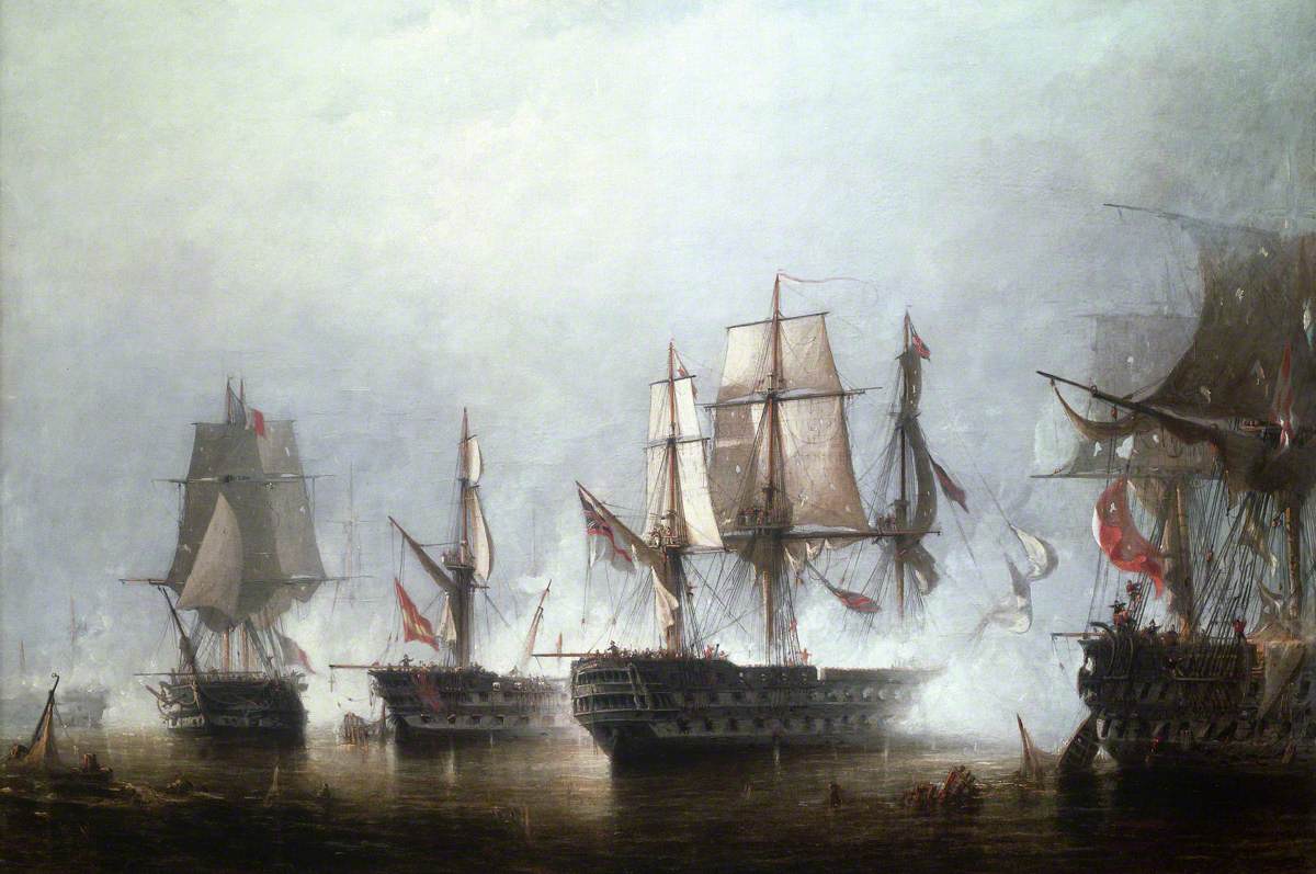
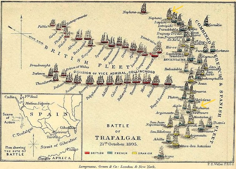
The Battle of Trafalgar, 21 October 1805, by Richard Henry Nibbs; National Maritime Museum. On the left the French Swiftsure, next to her the Spanish 76 Bahama, commanded by Dionisio Galiano, then HMS Colossus firing into the French Argonaute.
The historical encounter between British mariner George Vancouver and Spanish commodore Juan Francisco de la Bodega y Quadra in Nootka Sound in 1792 is the setting for The Wind From All Directions (coming in 2024: more on that in a later post). While Vancouver and Quadra, along with the Mowachaht chief Maquinna, played the lead roles in that true-life drama, each had the benefit of an able supporting cast. Yet those in supporting roles were no bit players: they were extraordinary characters in their own right. Witness the lives and careers of just three of those who feature in the events I’ve fictionalized in TWFAD.
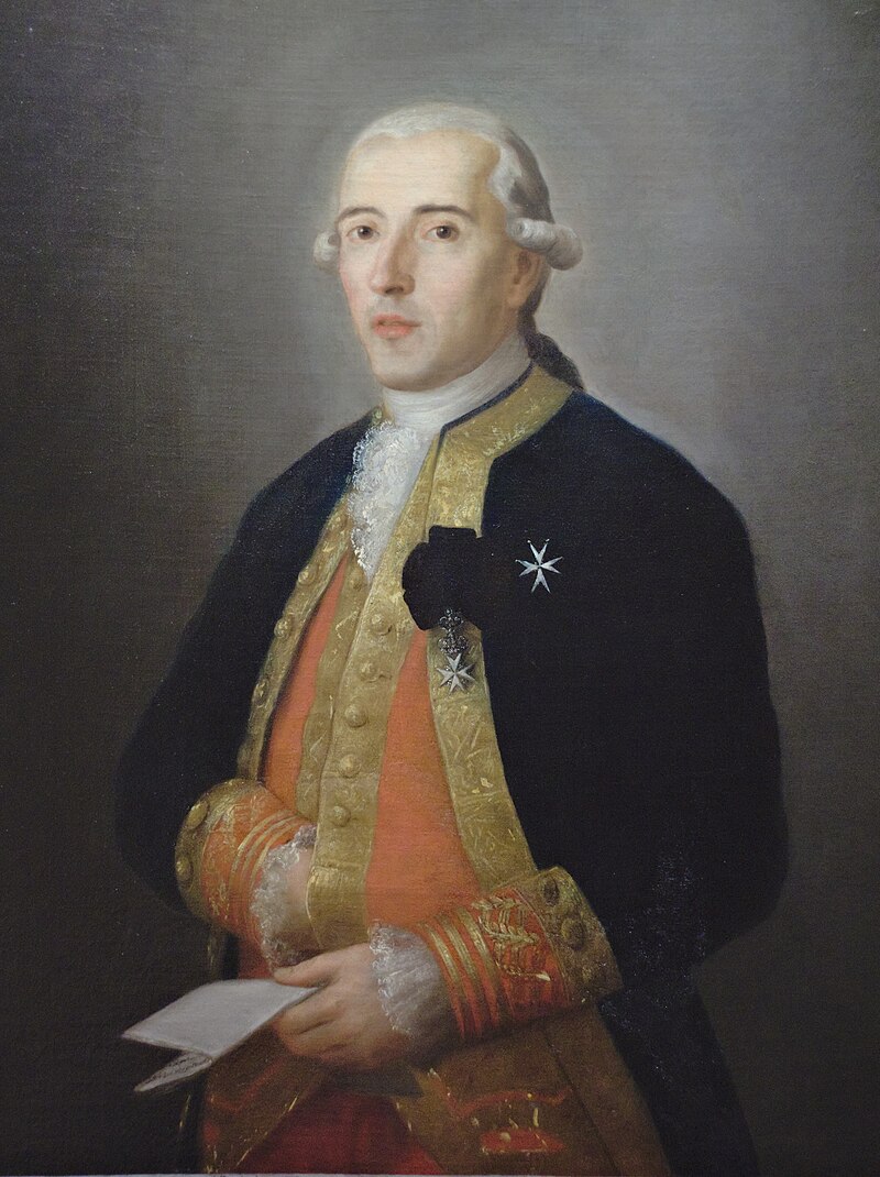
In 1792, three young Spanish officers led ambitious voyages of exploration in the Pacific northwest. Dionisio Alcalá Galiano and Cayetano Valdés y Flores conducted their missions on the schooners Sutil and Mexicana, Jacinto Caamaño Moraleja on the frigate Aránzazu.
Galiano
Valdés
Dionisio Galiano and Cayetano Valdés had orders to probe the Strait of Juan de Fuca and the unknown inland waterway to which it led. On June 21, 1792, while anchored off the Spanish Banks near the present-day city of Vancouver, they encountered George Vancouver, who was engaged on a similar mission. Both parties had orders to collaborate in the event they met, and that’s exactly what they did. Working closely together over a period of weeks, the officers of two oft-competing navies developed a collegial respect for, and friendship with, their counterparts.
The names Galiano and Valdés are often linked in Canada, for they conducted their mission together; but both men were accomplished in their own right.
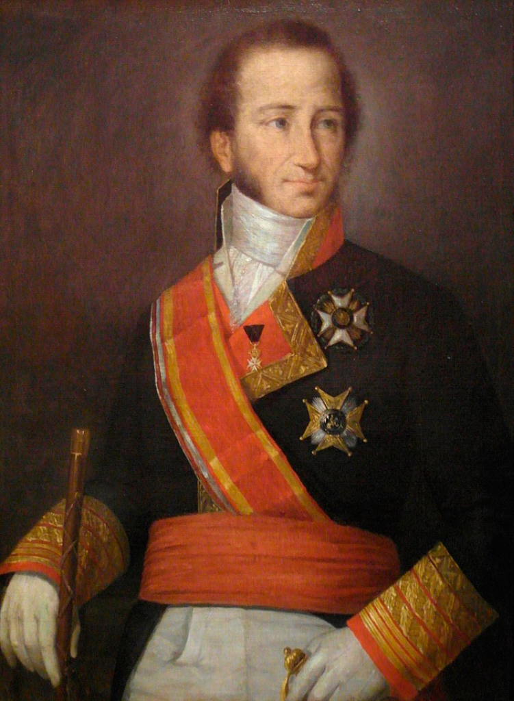
Vicente Tofiño
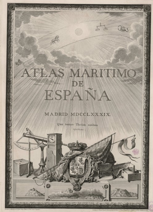
Dionisio Galiano was born in Cordoba in 1760. He entered the navy at 11, attended the Spanish naval college at 15, and graduated at 19. He showed promise as a mapmaker and surveyor, and was selected for advanced training in astronomy under Admiral Vicente Tofiño, the director of the naval Academies of Cádiz, El Ferrol and Cartagena. Tofiño subsequently chose him to work on the first comprehensive hydrographic survey of the Iberian peninsula, which produced the Atlas Maritímo de España. Galiano also surveyed the Azores and the Strait of Magellan. In 1789, he was appointed hydrographer on an around-the-world scientific expedition led by Alejandro Malaspina, a voyage as ambitious as those led previously by Britain’s James Cook or France’s comte de Lapérouse. In 1792, Malaspina detached Galiano, along with Cayetano Valdés, to examine the intricate waterways comprising the Salish Sea. They were in quest of the fabled Northwest Passage when they encountered Vancouver, who was doing the same thing.
Antonio Valdez – by Francisco de Goya. Fundación Goya en Aragón
Cayetano Valdés was born in 1767 in Seville. He was the nephew of Antonio Valdés y Fernández Bazán, a senior naval officer who eventually became Navy minister and minister of the Indies. (It was Valdés the uncle who counselled Spain’s King Carlos III to commission the survey that led to the publication of the Atlas Maritímo; he is also credited with the design of the current Spanish flag, originally created in 1785 as a naval ensign.)
Young Valdés entered the naval academy in Cádiz at 14. On graduation, he served at sea, seeing action against the British during the American Revolution, and against Barbary pirates off the coast of Africa. In 1789, he was appointed to serve as a lieutenant on Malaspina’s voyage, where his name became inextricably linked with that of his friend Galiano.
After they completed their joint mission in the northwest, both men returned to Spain. They found a country in chaos. Defeated by revolutionary France, the Spanish Empire unexpectedly joined the French cause in 1796, and Galiano and Valdés went to war against their former British friends. They served in Europe, the Atlantic, and the Caribbean, escorting convoys, path-finding for treasure fleets, running British blockades.
Bahama, by Rafael Berenguer (1822-1890) – Museo Naval de Madrid
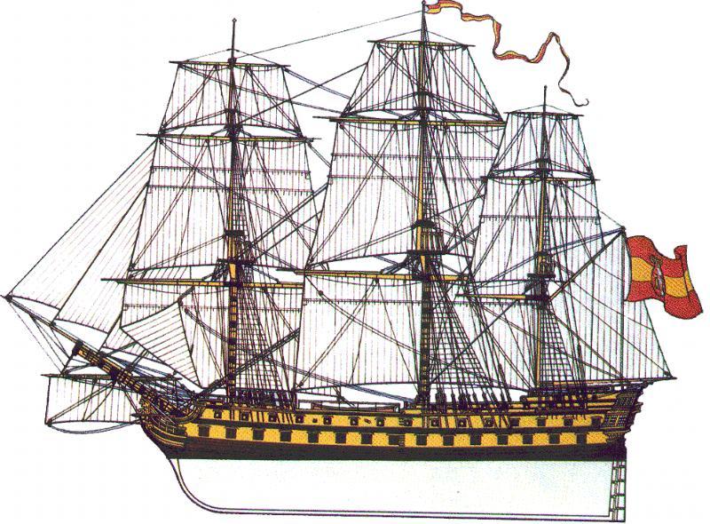
At Trafalgar in 1805, they both commanded ships of the line, Galiano the 76-gun Bahama, Valdés the 80-gun Neptuno—the latter of which led the combined French and Spanish fleet in line of battle against Nelson’s. After his first pass, Valdés wheeled to re-engage the British. The French ships following him did not. Neptuno was surrounded and disabled; Valdés was wounded and ultimately forced to surrender his ship. His friend Dionisio Galiano was killed on Bahama during the battle. He was buried at sea.
The rest of Cayetano Valdés’s life reads like an epic. He was held prisoner in England until Napoleonic France invaded Spain and deposed its new king, Ferdinand VII, in 1808. Occupied Spain then switched sides to join Britain against France, and Valdés returned home to find revolutionaries and reformers pitted against absolute monarchists and reactionaries. He allied himself with the reformers, who created Spain’s first constitution, the most liberal of its time—so liberal that the absolutist Ferdinand repealed it on his restoration five years later. A wave of repression followed, and Valdés narrowly evaded execution. In 1820, a military coup returned the liberals to power, and he returned to government, this time as minister of war. In 1823, France again intervened militarily, this time to restore Ferdinand to power. Valdés was sentenced to death, but escaped to Gibraltar and exile. On Ferdinand’s death in 1833, he received a pardon. He returned to Spain to become Captain-General of Cádiz and head of the Spanish navy. He died in 1835.
Jacinto Caamaño was the third of the three remarkable young officers who led voyages on the northwest coast in 1792. He was born in 1759 in Madrid to an aristocratic family with roots in Santiago de Compostela. Although he entered naval service at 18 in 1777, he never attended the naval academy. Instead, he joined as an aventurero (adventurer), a path for a young man to gain practical training and experience on a warship while working towards a commission. His work paid off. By 20 he was an alférez de navio (ensign); he was later promoted to lieutenant. He served in home waters, the Caribbean, and the Mediterranean, and at some point came to the notice of Juan Francisco de la Bodega y la Quadra. When Quadra was assigned to assert Spain’s claim to the northwest coast of America (by the minister for the Navy and the Indies—Antonio Valdés, again!), he chose Caamaño as one of six officers to join the endeavour. Caamaño made his first voyage to Nootka Sound from San Blas, Spain’s Pacific naval base in Mexico, in 1790. In 1792, commanding Aránzazu, he was assigned to chart the coast south from Bucareli Bay in Alaska (at 55° N) towards Nootka Sound. By the time he sailed into Nootka that September, he had proven that the Northwest Passage did not lie between the 51st and 55th parallels. While in port, he met with Vancouver, and shared his charts with him. When Vancouver conducted his own survey of those waters, he cross-referenced his results with Caamaño’s. He retained many of the names Caamaño had given to the area’s geographic features; many of these names survive to the present.
Caamaño’s voyage was the last great Spanish voyage of exploration in the Pacific northwest. In addition to its cartographic achievements, the expedition gathered a great deal of information about the area’s ecosystem and the peoples it encountered—the Tlingit, the Tsimshian, and the Haida.
The Battle of Pichincha, the decisive battle in the war that led to Ecuador’s independence. Artist unknown.
Unlike Galiano and Valdés, Caamaño never returned to Spain. Over the next fifteen years he served in various naval positions in Mexico and Peru. He eventually settled in Guayaquil, where he married and had eight children. In 1809 he retired from the Spanish navy to become Guayaquil’s harbourmaster. History’s last glimpse of him was in 1820, on the birth of his youngest daughter. That same year, Guayaquil proclaimed its independence, and war with Spain followed.
It is believed that Jacinto Caamaño died in 1829. There is no known image of him.
José Plácido Caamaño
Jacinto Jijón y Caamaño
Caamaño’s descendants played prominent roles in the new republic of Ecuador. His grandson, José Plácido Caamaño, served as the country’s president in the 1880’s. His great-grandson, Jacinto Jijón y Caamaño, an historian and archaeologist, was a candidate for the presidency in 1940. He also served in parliament and as mayor of Quito. Another great-grandson, Ernesto Noboa y Caamaño, was a poet. He committed suicide in 1927, and historians retrospectively counted him a member of Ecuador’s generación decapitada, a group of promising young poets who were never actually a group, but who all died by their own hand.
Sometimes, there is no escaping revisionism. Perhaps it’s preferable to being forgotten entirely. In my view, when it comes to history, it’s best to present the facts, and let the reader decide. Fiction, though, is a completely different story.
This post is a technical supplement to my post Neglected Treasures. It provides background on the subject of longitude, which is touched upon in Neglected Treasures in the course of discussing two vintage navigational instruments in the collection of the Vancouver Maritime Museum.
A map is simplicity itself. Two dimensions—north-south, east-west—depicted on a flat surface. And yet to create one (let alone use one as a navigator) demands mastery of the dimensions of space and time.
A mastery (i.e. understanding) of space (consider it infinite height), paradoxically enables mere mortals to locate a place on the surface of the Earth. Observe the sky and measure the angle from the horizon to the Sun at its zenith, or to Polaris at night, to yield a north-south coordinate, the dimension called latitude, the distance north or south of the equator.
An understanding of space also yields the east-west coordinate, called longitude, via the fourth dimension, time. Consider that the Earth rotates on its axis completely (i.e. travels through 360 degrees) every 24 hours. At every place on the planet, tomorrow’s celestial noon (the moment at which the Sun is highest in the sky) follows today’s by exactly 24 hours—thus every place on the planet is exactly 360 degrees distant from itself. And for any place (say the Royal Observatory at Greenwich, England) there is a single location exactly 90 degrees west of it; or 6 hours (90/360 x 24), at the speed the Sun appears to travel across the Earth’s sky. Any place due north or south of that spot is also 90 degrees or 6 hours from Greenwich on that east-west axis. When the Sun reaches its daily zenith anywhere on that north-south line (or “meridian”) 90 degrees west of Greenwich, it is noon locally—and 6 pm in Greenwich.
A mariner, observing the Sun at its zenith anywhere on Earth, could find the spot’s longitude simply by reference to a clock showing the true time at Greenwich. It is but a case of simple math—if the timepiece keeps perfect time. But well into the eighteenth century, no clock did. Instrumentation was primitive, and clocks performed poorly outside conditions of perfect stillness. A ship’s motion, as well as salt air and variations in humidity, temperature, and atmospheric pressure, all affected a clock’s mechanism. No clock then in existence could actually weather weather.
Harrison’s H4 marine chronometer
Only in the 1760’s did English clockmaker John Harrison craft a timepiece—a “sea watch” or marine chronometer—that seemed to be up to the challenge. This clock, called H4, was tested widely, to mixed results; it was deemed useful, but not widely embraced as a solution to the longitude conundrum. As proof-of-concept, the British Admiralty commissioned another clockmaker, Larcum Kendall, to produce a copy of H4. Kendall’s piece, known as K1, was tested by James Cook on his second South Sea voyage (1772-75), on which George Vancouver first went to sea. It performed superbly. From that moment, all important naval expeditions were supplied with marine chronometers to determine longitude. The problem was, those early man-made timepieces were few in number, and finicky. They could not be relied upon exclusively to determine longitude. And so, mariners devised a method to use the Moon as a clock.
The Moon and the Sun are the most prominent celestial bodies visible from Earth. The movements of both are predictable: where they will be in the sky at any time can be calculated with absolute certainty. So too can the positions of other celestial bodies, like Mars, Venus, or Regulus. Being predictable in their own right, their positions relative to each other are also predictable.
The Sun’s brilliance makes it is difficult to see stars and planets during the day, but the Moon does not render celestial bodies invisible. Using a sextant, a mariner at sea can measure the angular distance from the Moon to another visible object. Anyone observing those two bodies at that moment anywhere on Earth would measure the same angle, and the time at which that angle occurred could be calculated for a place of known longitude—like Greenwich. If one had the angle (by observation), and knew the time at Greenwich at which it would occur (by calculation), as well as the local celestial time (by observation), one had one’s local longitude.
This is the “lunar distance method,” and it is complicated and challenging. From the deck of a rolling ship it is hard to measure distances and angles from the horizon or between celestial bodies. The readings require adjustment to correct for visual distortions from parallax and atmospheric refraction. Then, lengthy calculations must be performed with the corrected values. Those calculations, if performed by hand, could take a good mathematician four hours. And not every mariner is a good mathematician.
Beginning in 1767, a Nautical Almanac was published to ease the burden of computation. The almanac contained tables with the angular distances between the Moon and the most prominent celestial bodies, on Greenwich time, for every day of the year, for years ahead, as pre-computed by mathematicians and astronomers. Thereafter navigators at sea could determine their longitude from a sighting much more quickly, although their measurement issues remained.
George Vancouver’s 1791-1795 expedition (which is at the center of The Wind From All Directions) used both the lunar distance method and marine chronometers to determine longitude. The lunar distance method, while theoretically perfect, was in practice tricky and cumbersome. Numerous sets of celestial observations by numerous observers were taken at each location and averaged to come up with dependable coordinates for use in mapmaking. These were checked against the longitudes determined from his five chronometers, each of which was finicky in its own fashion. Each had to be tested constantly to determine its “rate of going,” the rate at which it gained or lost time. Often this rate fluctuated markedly. Once the error was understood, it was necessary to adjust the readings each timepiece gave, and to continue doing so, as the rate of going varied.
Determining longitude was a painstaking process. Eighteenth century mapmakers would be amazed at the ease with which the task is accomplished today, with the benefit of satellites and GPS.
While researching The Wind From All Directions I’ve immersed myself in the place and time in which it is based. This has taken me deep into the late eighteenth century and subjects as diverse as square-rigged tall ships, nautical exploration, mapmaking, Indigenous culture and history, imperial conflict, the maritime fur trade, even ravens. One of the topics that drew me deepest, for a number of reasons, related to the challenging conundrum of longitude.
On a recent visit to the Vancouver Maritime Museum I stumbled upon two rare artefacts from the 1791-1795 voyage of George Vancouver. Stumbled, because they were displayed without fanfare or context, with no explanation of their historical significance, much less their value to a mariner of their time. One might wonder why they warrant a place in a museum at all. And they certainly do—especially in the VMM.
Both items—a sextant, and a marine chronometer—are navigational instruments which, before the advent of GPS, were crucial to mariners for determining their position at sea.
Joseph Baker’s sextant
John Arnold’s marine chronometer No 176
The sextant on display once belonged to Joseph Baker, Vancouver’s Third Lieutenant on HMS Discovery. Baker was the principal mapmaker on the voyage, which produced the first comprehensive set of charts of the Pacific northwest. Mount Baker, the magnificent stratovolcano in Washington State that is visible from both Vancouver and Victoria, is named for him.
A sextant is an essential tool for celestial navigation. It is used to measure the angle (“angular distance”) between two visible objects. Sighting upon an astronomical object and measuring its angle or “altitude” against a point of reference allows a navigator to determine a ship’s coordinates—its latitude and longitude. Latitude is easy to determine from the angle between the horizon and the sun at noon, or between the horizon and Polaris at night.
(Even describing the methods used to determine longitude is complicated. If you are interested, I have posted a technical note that explains the lunar distance method, and the role of chronometers, on this link.)
Longitude, however, is much more complicated, and a way to measure it eluded mariners for centuries. Finally, in the mid-1700s, mathematician-astronomers devised an accurate method, based on the predictable movement of the moon and other celestial bodies across the sky. This “lunar distance method” effectively used the moon as a clock. Using this method, a mapmaker or navigator could convert a sighting made with a sextant like Baker’s into an actual longitude, although it involved a time-consuming and complicated procedure. A real clock would be far preferable, but a clock that could withstand the rigours of operation aboard a ship at sea—where there are wide variations in temperature, humidity, and air pressure, and continuous exposure to salt and the ship’s erratic motion—did not exist.
John Harrison (1693-1776), English clockmaker, by Thomas King
It was only with advancements in clockmaking through the eighteenth century that effective marine timepieces could be produced. Early models were produced at great expense by craftsmen, working at an excruciatingly slow pace, every part hand crafted. John Harrison, the Steve Jobs of his era, produced only 4, Larcum Kendall (Samsung to Harrison’s Jobs) only 3. Other early makers were Thomas Mudge (coincidentally, the uncle to Vancouver’s First Lieutenant, Zachary Mudge), Thomas Earnshaw, and John Arnold, the latter two of whom simplified the mechanism and increased production volume. Arnold for example, produced a total of 82 marine chronometers, of which 15 survive. One of those is Arnold’s #176, the well-travelled chronometer I discovered lying humbly under-curated and unexplained in the Vancouver Maritime Museum. It’s there because it was used by George Vancouver (and Joseph Baker) during their historic mission of exploration in the Pacific northwest.
John Arnold, attributed to Mason Chamberlin, ca. 1767
Larcum Kendall’s marine chronometer K3, at the Royal Maritime Museum in Greenwich
The Vancouver expedition left England in 1791 with two chronometers: Kendall’s K3 (which James Cook had also used on his third voyage); and Arnold’s #82. Months later, the Admiralty dispatched the supply ship Daedalus to rendezvous with Vancouver’s ships half-way around the world. It carried three additional chronometers: a pocket piece made by Thomas Earnshaw, and two by John Arnold, #14 and the VMM’s #176. Both new Arnold pieces cost the princely sum of £84 (worth approx. £10,000 today).
George Vancouver
Vancouver received the three new chronometers in Nootka Sound. They were used for the duration of the voyage. All five chronometers varied in dependability, and these variations created problems for mapmaking. In an effort to reconcile their differences, Vancouver and his officers took hundreds of celestial sightings to compare the longitudes calculated by the lunar method to those determined by the chronometers. Vancouver kept meticulous notes on the performance of each clock. Arnold’s #176 was noted to gain time, somewhat erratically, impairing its reliability.
Matthew Flinders, by Antoine Toussaint de Chazal
Vancouver returned his five chronometers to the Admiralty when the voyage returned to England in 1795. The Admiralty paid Arnold’s firm £32 to have #176 cleaned, adjusted, and housed in a new wooden box. In 1801 it was assigned to the Royal Navy’s Matthew Flinders for his voyage of exploration to Australia. It stopped shortly after Flinders reached Australia, and he sent it back to England for repair at the first opportunity. It returned to Australia with William Bligh (of Mutiny on theBounty fame) when Bligh became Governor of New South Wales in 1805. He was not on a naval/exploratory mission there, but on his appointment he requested a chronometer “to the benefit of the public service”.
William Bligh, pictured in his 1792 account of the mutiny voyage, A Voyage to the South Sea
Perhaps Bligh should have stuck to navigation, at which he excelled. In New South Wales, he was deposed from the governership—again, by mutiny. He returned to England in 1811. A year later, the Board of Longitude sent him a letter asking him to return Arnold’s #176. It is not clear if Bligh did so, or if it was even in his possession. After that letter, it disappeared from the historical record for 170 years, although historian Robin Inglis notes that when it reappeared, it had the address for Arnold’s business on its lid, an address that the business did not occupy until 1817. This suggests that #176 had returned to England prior to that date, and that it was sent to Arnold’s son, John Roger Arnold, for repair and maintenance. Where it went subsequently is a mystery.
Robin Inglis tells the tale of its reappearance and ultimate acquisition:
“In July, 1981, quite unexpectedly, Arnold 176 was found in private hands in Southern England. It had come down to the owners from a branch of their family and had rested quietly on their hall table for many years. Prepared to sell it, they sought the advice of a naval friend whose initial researches soon uncovered the outlines of its remarkable history. Further investigation carried out primarily in the Board of Longitude papers and at the National Maritime Museum at Greenwich soon demonstrated that Arnold 176 was the most historically important English chronometer to be offered for sale this century. The very few chronometers purchased by the Board of Longitude for major voyages, and still existing, are almost all in the collections of the British National Maritime Museum and British Museum, which held Kendall 3 and Arnold 14 respectively. The appearance of Arnold 176 meant that three of the five timepieces used on Vancouver’s voyage were still extant.
“The chronometer came up for sale at Christie’s Auction House in London on November 25th, 1981. With the help of grants from the Canadian Government’s Cultural Property Review Board, the Province of British Columbia, and the City of Vancouver, the Vancouver Maritime Museum successfully bid £36,000 or CAN $92,000 for the instrument, the highest price ever paid for an Arnold chronometer. An export permit, however, was not granted until the following February after a full hearing by the British Government’s Reviewing Committee on the Export of Works of Art. Arnold 176 was deemed important enough to England’s maritime heritage to be retained in that country and offered to a museum there at the price paid for it by Vancouver. The Committee decided nevertheless that it was a link of outstanding importance to the history of Canada’s West Coast. After a period of further study by experts at the British Museum, in which Arnold 176 was tested and compared with other Arnold chronometers, it returned to British Columbia and was placed on exhibit in June 1982, 190 years to the day when George Vancouver first entered English Bay.
“Arnold 176 is a significant treasure not only because it is one of the few extant 18th Century representatives of a technological breakthrough in watchmaking that solved the problem of longitude, but also because of its clearly documented link with three great English navigators—Vancouver, Flinders and Bligh. It was first used in British Columbia waters and is arguably the most important maritime artifact in public hands in Canada—the only one directly related to George Vancouver in this country…”
This is the background to the acquisition of Arnold’s historic chronometer. What Mr Inglis does not say is that he was instrumental in its purchase. Robin Inglis is an authority on the early exploration of the Northwest Coast, and an internationally-respected expert on the Spanish presence in the North Pacific. He once served as director of the Vancouver Maritime Museum. When he learned of the chronometer’s availability, he sought and secured funds for its purchase, cobbling it from the various sources cited above. Then he travelled to London to participate in the auction. At Christie’s, there was strong interest, particularly from a telephone bidder in Germany and an Australian buyer represented in the audience by an agent. The atmosphere was tense and the action fast. Ultimately Mr Inglis’s bid was successful. Without his effort, this historically-significant timepiece would have been lost to the City of Vancouver and to Canada.
Now, more than 40 years later, Arnold’s #176 languishes in anonymity amid other exhibits at the Museum. It’s a pity that this historic chronometer is not displayed more prominently, and that its fascinating history is not better explained to Museum visitors. Today’s VMM curators should surely step up their efforts to highlight its historical significance—along with that of Joseph Baker’s sextant.
Sources:
Robin Inglis, “Arnold 176: The Vancouver Chronometer,” Australiana, November 1986