This post is a technical supplement to my post Neglected Treasures. It provides background on the subject of longitude, which is touched upon in Neglected Treasures in the course of discussing two vintage navigational instruments in the collection of the Vancouver Maritime Museum.
A map is simplicity itself. Two dimensions—north-south, east-west—depicted on a flat surface. And yet to create one (let alone use one as a navigator) demands mastery of the dimensions of space and time.
A mastery (i.e. understanding) of space (consider it infinite height), paradoxically enables mere mortals to locate a place on the surface of the Earth. Observe the sky and measure the angle from the horizon to the Sun at its zenith, or to Polaris at night, to yield a north-south coordinate, the dimension called latitude, the distance north or south of the equator.
An understanding of space also yields the east-west coordinate, called longitude, via the fourth dimension, time. Consider that the Earth rotates on its axis completely (i.e. travels through 360 degrees) every 24 hours. At every place on the planet, tomorrow’s celestial noon (the moment at which the Sun is highest in the sky) follows today’s by exactly 24 hours—thus every place on the planet is exactly 360 degrees distant from itself. And for any place (say the Royal Observatory at Greenwich, England) there is a single location exactly 90 degrees west of it; or 6 hours (90/360 x 24), at the speed the Sun appears to travel across the Earth’s sky. Any place due north or south of that spot is also 90 degrees or 6 hours from Greenwich on that east-west axis. When the Sun reaches its daily zenith anywhere on that north-south line (or “meridian”) 90 degrees west of Greenwich, it is noon locally—and 6 pm in Greenwich.
A mariner, observing the Sun at its zenith anywhere on Earth, could find the spot’s longitude simply by reference to a clock showing the true time at Greenwich. It is but a case of simple math—if the timepiece keeps perfect time. But well into the eighteenth century, no clock did. Instrumentation was primitive, and clocks performed poorly outside conditions of perfect stillness. A ship’s motion, as well as salt air and variations in humidity, temperature, and atmospheric pressure, all affected a clock’s mechanism. No clock then in existence could actually weather weather.
Harrison’s H4 marine chronometer
Only in the 1760’s did English clockmaker John Harrison craft a timepiece—a “sea watch” or marine chronometer—that seemed to be up to the challenge. This clock, called H4, was tested widely, to mixed results; it was deemed useful, but not widely embraced as a solution to the longitude conundrum. As proof-of-concept, the British Admiralty commissioned another clockmaker, Larcum Kendall, to produce a copy of H4. Kendall’s piece, known as K1, was tested by James Cook on his second South Sea voyage (1772-75), on which George Vancouver first went to sea. It performed superbly. From that moment, all important naval expeditions were supplied with marine chronometers to determine longitude. The problem was, those early man-made timepieces were few in number, and finicky. They could not be relied upon exclusively to determine longitude. And so, mariners devised a method to use the Moon as a clock.
The Moon and the Sun are the most prominent celestial bodies visible from Earth. The movements of both are predictable: where they will be in the sky at any time can be calculated with absolute certainty. So too can the positions of other celestial bodies, like Mars, Venus, or Regulus. Being predictable in their own right, their positions relative to each other are also predictable.
The Sun’s brilliance makes it is difficult to see stars and planets during the day, but the Moon does not render celestial bodies invisible. Using a sextant, a mariner at sea can measure the angular distance from the Moon to another visible object. Anyone observing those two bodies at that moment anywhere on Earth would measure the same angle, and the time at which that angle occurred could be calculated for a place of known longitude—like Greenwich. If one had the angle (by observation), and knew the time at Greenwich at which it would occur (by calculation), as well as the local celestial time (by observation), one had one’s local longitude.
This is the “lunar distance method,” and it is complicated and challenging. From the deck of a rolling ship it is hard to measure distances and angles from the horizon or between celestial bodies. The readings require adjustment to correct for visual distortions from parallax and atmospheric refraction. Then, lengthy calculations must be performed with the corrected values. Those calculations, if performed by hand, could take a good mathematician four hours. And not every mariner is a good mathematician.
Beginning in 1767, a Nautical Almanac was published to ease the burden of computation. The almanac contained tables with the angular distances between the Moon and the most prominent celestial bodies, on Greenwich time, for every day of the year, for years ahead, as pre-computed by mathematicians and astronomers. Thereafter navigators at sea could determine their longitude from a sighting much more quickly, although their measurement issues remained.
George Vancouver’s 1791-1795 expedition (which is at the center of The Wind From All Directions) used both the lunar distance method and marine chronometers to determine longitude. The lunar distance method, while theoretically perfect, was in practice tricky and cumbersome. Numerous sets of celestial observations by numerous observers were taken at each location and averaged to come up with dependable coordinates for use in mapmaking. These were checked against the longitudes determined from his five chronometers, each of which was finicky in its own fashion. Each had to be tested constantly to determine its “rate of going,” the rate at which it gained or lost time. Often this rate fluctuated markedly. Once the error was understood, it was necessary to adjust the readings each timepiece gave, and to continue doing so, as the rate of going varied.
Determining longitude was a painstaking process. Eighteenth century mapmakers would be amazed at the ease with which the task is accomplished today, with the benefit of satellites and GPS.
While researching The Wind From All Directions I’ve immersed myself in the place and time in which it is based. This has taken me deep into the late eighteenth century and subjects as diverse as square-rigged tall ships, nautical exploration, mapmaking, Indigenous culture and history, imperial conflict, the maritime fur trade, even ravens. One of the topics that drew me deepest, for a number of reasons, related to the challenging conundrum of longitude.
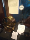
On a recent visit to the Vancouver Maritime Museum I stumbled upon two rare artefacts from the 1791-1795 voyage of George Vancouver. Stumbled, because they were displayed without fanfare or context, with no explanation of their historical significance, much less their value to a mariner of their time. One might wonder why they warrant a place in a museum at all. And they certainly do—especially in the VMM.
Both items—a sextant, and a marine chronometer—are navigational instruments which, before the advent of GPS, were crucial to mariners for determining their position at sea.
Joseph Baker’s sextant
John Arnold’s marine chronometer No 176
The sextant on display once belonged to Joseph Baker, Vancouver’s Third Lieutenant on HMS Discovery. Baker was the principal mapmaker on the voyage, which produced the first comprehensive set of charts of the Pacific northwest. Mount Baker, the magnificent stratovolcano in Washington State that is visible from both Vancouver and Victoria, is named for him.
A sextant is an essential tool for celestial navigation. It is used to measure the angle (“angular distance”) between two visible objects. Sighting upon an astronomical object and measuring its angle or “altitude” against a point of reference allows a navigator to determine a ship’s coordinates—its latitude and longitude. Latitude is easy to determine from the angle between the horizon and the sun at noon, or between the horizon and Polaris at night.
(Even describing the methods used to determine longitude is complicated. If you are interested, I have posted a technical note that explains the lunar distance method, and the role of chronometers, on this link.)
Longitude, however, is much more complicated, and a way to measure it eluded mariners for centuries. Finally, in the mid-1700s, mathematician-astronomers devised an accurate method, based on the predictable movement of the moon and other celestial bodies across the sky. This “lunar distance method” effectively used the moon as a clock. Using this method, a mapmaker or navigator could convert a sighting made with a sextant like Baker’s into an actual longitude, although it involved a time-consuming and complicated procedure. A real clock would be far preferable, but a clock that could withstand the rigours of operation aboard a ship at sea—where there are wide variations in temperature, humidity, and air pressure, and continuous exposure to salt and the ship’s erratic motion—did not exist.
John Harrison (1693-1776), English clockmaker, by Thomas King
It was only with advancements in clockmaking through the eighteenth century that effective marine timepieces could be produced. Early models were produced at great expense by craftsmen, working at an excruciatingly slow pace, every part hand crafted. John Harrison, the Steve Jobs of his era, produced only 4, Larcum Kendall (Samsung to Harrison’s Jobs) only 3. Other early makers were Thomas Mudge (coincidentally, the uncle to Vancouver’s First Lieutenant, Zachary Mudge), Thomas Earnshaw, and John Arnold, the latter two of whom simplified the mechanism and increased production volume. Arnold for example, produced a total of 82 marine chronometers, of which 15 survive. One of those is Arnold’s #176, the well-travelled chronometer I discovered lying humbly under-curated and unexplained in the Vancouver Maritime Museum. It’s there because it was used by George Vancouver (and Joseph Baker) during their historic mission of exploration in the Pacific northwest.
John Arnold, attributed to Mason Chamberlin, ca. 1767
Larcum Kendall’s marine chronometer K3, at the Royal Maritime Museum in Greenwich
The Vancouver expedition left England in 1791 with two chronometers: Kendall’s K3 (which James Cook had also used on his third voyage); and Arnold’s #82. Months later, the Admiralty dispatched the supply ship Daedalus to rendezvous with Vancouver’s ships half-way around the world. It carried three additional chronometers: a pocket piece made by Thomas Earnshaw, and two by John Arnold, #14 and the VMM’s #176. Both new Arnold pieces cost the princely sum of £84 (worth approx. £10,000 today).
George Vancouver
Vancouver received the three new chronometers in Nootka Sound. They were used for the duration of the voyage. All five chronometers varied in dependability, and these variations created problems for mapmaking. In an effort to reconcile their differences, Vancouver and his officers took hundreds of celestial sightings to compare the longitudes calculated by the lunar method to those determined by the chronometers. Vancouver kept meticulous notes on the performance of each clock. Arnold’s #176 was noted to gain time, somewhat erratically, impairing its reliability.
Matthew Flinders, by Antoine Toussaint de Chazal
Vancouver returned his five chronometers to the Admiralty when the voyage returned to England in 1795. The Admiralty paid Arnold’s firm £32 to have #176 cleaned, adjusted, and housed in a new wooden box. In 1801 it was assigned to the Royal Navy’s Matthew Flinders for his voyage of exploration to Australia. It stopped shortly after Flinders reached Australia, and he sent it back to England for repair at the first opportunity. It returned to Australia with William Bligh (of Mutiny on theBounty fame) when Bligh became Governor of New South Wales in 1805. He was not on a naval/exploratory mission there, but on his appointment he requested a chronometer “to the benefit of the public service”.
William Bligh, pictured in his 1792 account of the mutiny voyage, A Voyage to the South Sea
Perhaps Bligh should have stuck to navigation, at which he excelled. In New South Wales, he was deposed from the governership—again, by mutiny. He returned to England in 1811. A year later, the Board of Longitude sent him a letter asking him to return Arnold’s #176. It is not clear if Bligh did so, or if it was even in his possession. After that letter, it disappeared from the historical record for 170 years, although historian Robin Inglis notes that when it reappeared, it had the address for Arnold’s business on its lid, an address that the business did not occupy until 1817. This suggests that #176 had returned to England prior to that date, and that it was sent to Arnold’s son, John Roger Arnold, for repair and maintenance. Where it went subsequently is a mystery.
Robin Inglis tells the tale of its reappearance and ultimate acquisition:
“In July, 1981, quite unexpectedly, Arnold 176 was found in private hands in Southern England. It had come down to the owners from a branch of their family and had rested quietly on their hall table for many years. Prepared to sell it, they sought the advice of a naval friend whose initial researches soon uncovered the outlines of its remarkable history. Further investigation carried out primarily in the Board of Longitude papers and at the National Maritime Museum at Greenwich soon demonstrated that Arnold 176 was the most historically important English chronometer to be offered for sale this century. The very few chronometers purchased by the Board of Longitude for major voyages, and still existing, are almost all in the collections of the British National Maritime Museum and British Museum, which held Kendall 3 and Arnold 14 respectively. The appearance of Arnold 176 meant that three of the five timepieces used on Vancouver’s voyage were still extant.
“The chronometer came up for sale at Christie’s Auction House in London on November 25th, 1981. With the help of grants from the Canadian Government’s Cultural Property Review Board, the Province of British Columbia, and the City of Vancouver, the Vancouver Maritime Museum successfully bid £36,000 or CAN $92,000 for the instrument, the highest price ever paid for an Arnold chronometer. An export permit, however, was not granted until the following February after a full hearing by the British Government’s Reviewing Committee on the Export of Works of Art. Arnold 176 was deemed important enough to England’s maritime heritage to be retained in that country and offered to a museum there at the price paid for it by Vancouver. The Committee decided nevertheless that it was a link of outstanding importance to the history of Canada’s West Coast. After a period of further study by experts at the British Museum, in which Arnold 176 was tested and compared with other Arnold chronometers, it returned to British Columbia and was placed on exhibit in June 1982, 190 years to the day when George Vancouver first entered English Bay.
“Arnold 176 is a significant treasure not only because it is one of the few extant 18th Century representatives of a technological breakthrough in watchmaking that solved the problem of longitude, but also because of its clearly documented link with three great English navigators—Vancouver, Flinders and Bligh. It was first used in British Columbia waters and is arguably the most important maritime artifact in public hands in Canada—the only one directly related to George Vancouver in this country…”
This is the background to the acquisition of Arnold’s historic chronometer. What Mr Inglis does not say is that he was instrumental in its purchase. Robin Inglis is an authority on the early exploration of the Northwest Coast, and an internationally-respected expert on the Spanish presence in the North Pacific. He once served as director of the Vancouver Maritime Museum. When he learned of the chronometer’s availability, he sought and secured funds for its purchase, cobbling it from the various sources cited above. Then he travelled to London to participate in the auction. At Christie’s, there was strong interest, particularly from a telephone bidder in Germany and an Australian buyer represented in the audience by an agent. The atmosphere was tense and the action fast. Ultimately Mr Inglis’s bid was successful. Without his effort, this historically-significant timepiece would have been lost to the City of Vancouver and to Canada.
Now, more than 40 years later, Arnold’s #176 languishes in anonymity amid other exhibits at the Museum. It’s a pity that this historic chronometer is not displayed more prominently, and that its fascinating history is not better explained to Museum visitors. Today’s VMM curators should surely step up their efforts to highlight its historical significance—along with that of Joseph Baker’s sextant.
Sources:
Robin Inglis, “Arnold 176: The Vancouver Chronometer,” Australiana, November 1986
Discovery & Chatham, June 11, 1792, by artist Steve Mayo
I’m happy to report that my historical novel, The Wind From All Directions, will be published in 2024 by Double Dagger Books. Double Dagger specializes in the field of conflict, security, peacemaking, and warfare. It publishes books about contemporary and historical conflict as well as memoir, military history, and fiction related to diplomacy and conflict. As its publisher, Phil Halton, says, “If you want peace, study war.”
Double Dagger and The Wind From All Directions are a great fit. The book is set in 1792, during a tense standoff in the Pacific northwest, when British and Spanish naval officers met, on Indigenous land, to resolve their countries’ competing claims to the region. As my friends know, I’ve been working on this book for a long time: twenty years, in fact (off and on). It has gone through many iterations, and many have advised me in its evolution. I am very pleased that their efforts finally bore fruit, and that the book will appear in print at last.
I will provide more details and dates on a later post.
Few residents of Canada’s west coast, and the Pacific northwest in general, are aware of Spain’s one-time presence in the region. And yet, a Spanish legacy surrounds them, in the form of geographical placenames. The Strait of Juan de Fuca. Galiano Island. Valdes Island. Texada. Saturna. The Spanish Banks. The San Juans. Tofino. Cast an eye over the map, and Spanish names abound. How did this transpire? Who were the people whose names live on? And how did their names survive to the present, when the Spanish presence in the region ultimately proved ephemeral?
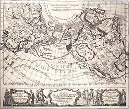
Map of America 1754 -1774
Origins
Spanish royal arms
In 1493, via a Papal Bull, Pope Alexander VI awarded the Spanish Crown titular sovereignty over a vast swath of territory that included the entire west coast of the Americas. The Bull was ignored by other countries, and Spain did nothing to enforce it in the Pacific northwest for almost three hundred years.
1774 map drawn by Juan Pérez
In 1774, Spanish officials in Mexico dispatched a single ship, the frigate Santiago commanded by Ensign Juan Pérez, to explore northwards along the Pacific coast. Perez arrived off Haida Gwaii in July. There, he interacted with a group of Haida, traded with them, but did not land. In August, on his return south, he anchored off Nootka Sound, where he was met by the Mowachaht. Again, the Spanish did not land, but interacted and traded with those who came out to their ship.
These were the first documented encounters between Europeans and the Indigenous inhabitants of what is today Canada’s west coast. They were notably peaceful, the meeting of equals. Later encounters were not always so.
Over the next decade, successive Spanish expeditions probed the coast. They were sent to monitor Russian expansion into the Americas, and to search for the fabled northwest passage, a shorter, more direct route to Europe than around the tip of South America. If such a passage existed, it would be immensely valuable to whomever controlled it.
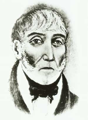
Esteban José Martínez
In 1788 ships captained by Esteban José Martínez and Gonzalo López de Haro encountered a Russian in Alaskan waters who told them that Russia intended to occupy Nootka Sound, on present-day Vancouver Island. This galvanized Spanish authorities into action. In 1789, the Viceroy of New Spain ordered Martínez to occupy Nootka and build a fortified settlement to assert Spanish sovereignty and pre-empt claims by other foreign powers. The Russians were thought to be just over the northern horizon, and British and American fur traders were known to be operating freely in the region. Martínez’s zealous exercise of his orders led to a fateful encounter with an English trader, James Colnett, one which brought Spain and England to the brink of war. I have written about that encounter in previous posts (for example – on this link). It set the stage for the events recounted in my forthcoming novel, The Wind From All Directions.
The Flood Tide
Martínez’s arrival in Nootka Sound marked the beginning of a period of ambitious Spanish endeavour in the Pacific northwest. In the years 1789 through 1795 the Spanish empire in the Americas reached its territorial peak. Its expansion was like a flood tide, and it ebbed quickly. Within three decades, Spain’s empire in the Americas crumbled, its colonies replaced by newly independent nation states. It was left in possession of Cuba and Puerto Rico, in the Caribbean.
“Baile en la Playa de Nutka” by Tomás de Suría, depicting the Spanish base at the mouth of Nootka Sound
But no one foresaw the future during the flood-tide period. The mariners sent to the region in the early years were generally pilots, which in the Spanish navy was a non-commissioned rank roughly corresponding to a ship’s master in the Royal Navy. They were highly trained and capable of sailing a ship, navigating, and conducting hydrographic surveys. The leaders of the 1788 voyage to Alaska, Martínez and Haro, were pilots. Later, operating from Santa Cruz de Nuca, the Spanish base at the mouth of Nootka Sound, they and other pilots were the first to chart many areas of the coast, and they named the features they mapped after saints, religious figures, superiors, nobles, home towns, and fellow explorers. Thus their own names were perpetuated on the Pacific coast. Martínez’s given name is commemorated in Estevan Point (shelled by a Japanese submarine in 1942, the first external attack on Canada since the Fenian Raids). Haro’s name is perpetuated in Haro Strait, off Victoria, and Lopez Island, in the San Juans.
The names of other pilots serving in the region also survive, largely due to the efforts of a Canadian hydrographer who, in 1934, proposed naming six islands in a small archipelago inside Nootka Sound after six of the early pilots—Juan Carrasco, Juan Vernacci, José Maria Narváez, José Verdia, Juan Pantoja, and Secundino Salamanca. He succeeded with five, and the archipelago is today known as the Spanish Pilot Group. His proposal to rename Spouter Island in the Group after Salamanca failed. Despite this rebuff, Salamanca’s name is perpetuated on the west coast: Salamanca Point, on Galiano Island, is named for him.
Near the Spanish Pilot Group lie two navigable passes, Fidalgo Passage, and Eliza Passage, named after Salvador Fidalgo, and Francisco de Eliza, officers who led significant voyages and played prominent roles during the period of Spanish expansion in the region. Fidalgo and Eliza Islands off the Washington coast are also namesakes for these officers.
Risky Business
In the years 1789 through 1791, life for the Spaniards at Santa Cruz de Nuca was difficult, and relations with the local Indigenous peoples were fraught. The Spanish complement peaked at more than 200 men. It is fair to say that their commanders were competent in marine matters, and wanting in diplomatic skills. They were poorly provisioned for surviving winter in the northwest, and at times their men resorted to taking what they needed to survive—or what they wanted. Atrocities and crimes were committed against Indigenous people by all the newcomers—Spaniards, and British and American traders operating in the region. These stories survive among the Mowachaht people, and are supported by historical accounts.
Alejandro Malaspina
In 1791 the Enlightenment arrived in Nootka Sound, in the person of Alejandro Malaspina. From 1789 to 1794, Malaspina led a round-the-world scientific expedition similar in ambition to those of his British and French contemporaries, Cook and Lapérouse. Malaspina’s expedition reached the north Pacific in 1791, where he explored and studied Alaska before turning south for Nootka Sound.
There, relations with the Mowachaht were as bad as they had ever been, and the diplomatic Malaspina—the most senior Spanish imperial official to visit the port to that point—set about improving them. He deployed his scientific subordinates to study their language and culture; he dispatched officers to meet Maquinna, the paramount Mowachaht chief. Eventually Maquinna came to meet Malaspina in person. Malaspina was successful in stabilizing relations with the local Indigenous peoples. Today his name is commemorated on the Pacific coast by Malaspina Strait, between the mainland and Texada Island (itself named for a Spanish Admiral), the Malaspina Peninsula and adjoining Malaspina Inlet in Desolation Sound, and Malaspina Glacier in Alaska.
Two of Malaspina’s officers, Ciriaco Zevallos and José Espinosa y Tello, are commemorated in the place names for the Zeballos and Esperanza Inlets on Vancouver Island. His expedition’s artist/draughtsman, Jose Cardero is commemorated by Cordero Channel (note how spellings change with innocent transcription errors), which is located between the mainland and Vancouver Island.
The Year of Quadra and Vancouver
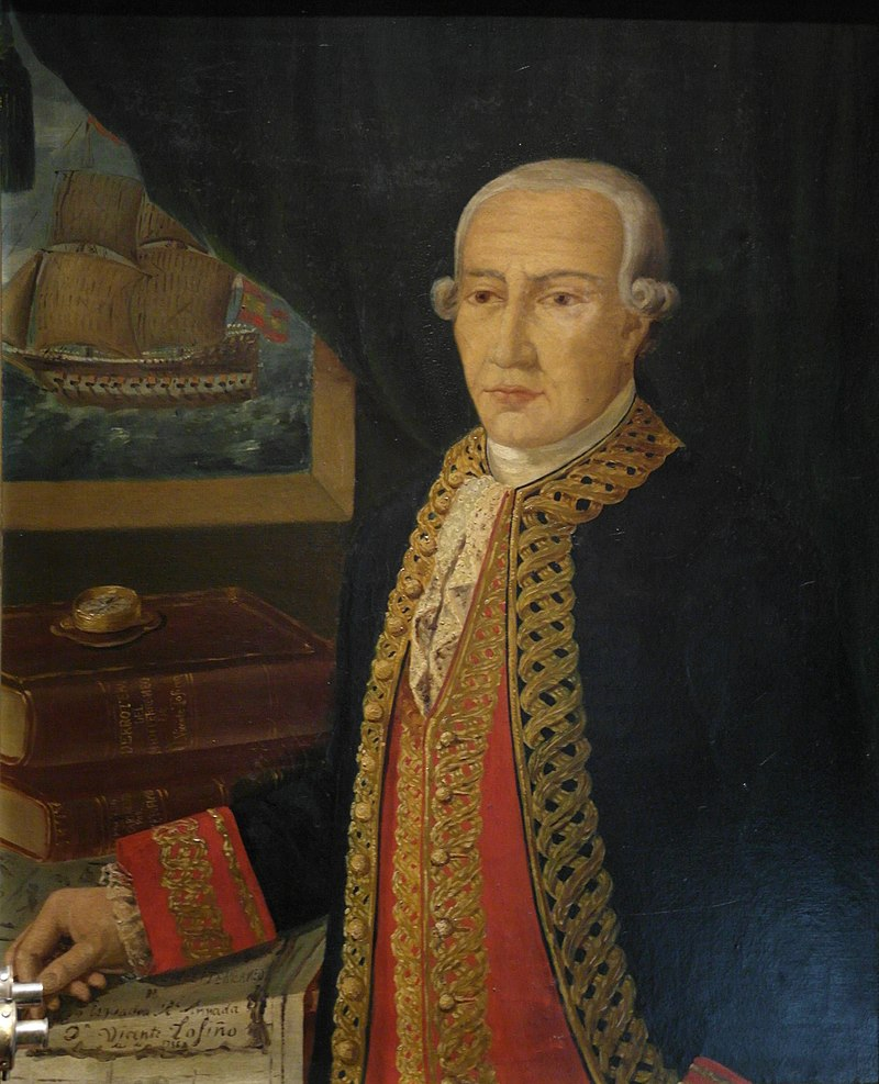
Juan Francisco de la Bodega y Quadra
In the following year—1792—Spanish commodore Juan Francisco de la Bodega y Quadra arrived in Santa Cruz de Nuca to assume command and launch a charm offensive of even greater impact than that of Malaspina. This was the year in which Spain’s reach and presence in the northwest peaked. Quadra reinforced Santa Cruz de Nuca and dispatched several ships under experienced officers to explore farther than had been possible in previous years.
Dionisio Alcalá Galiano
Dionisio Alcalá Galiano and Cayetano Valdés y Flores were tasked with exploring the Strait of Juan de Fuca (named for an apocryphal Greek serving Spain in the 1590s) and the interior waters to which it led. In June, the Royal Navy’s George Vancouver, on his own ambitious voyage of exploration, met them off the Spanish Banks near the present site of the city that bears his name. (He did not name it for himself; it would not be founded for decades.) The mariners had orders to collaborate if they met, and that’s exactly what they did.
Cayetano Valdés y Flores
For two weeks the two Spanish vessels and the two British ships proceeded in company, exploring north, before separating to pursue their individual missions. Vancouver reached Nootka Sound two months later. There he met Quadra, and they entered into a delicate negotiation over possession of the region. Their encounter is at the heart of The Wind From All Directions, which readers know I am ever happy to natter on about. But I digress: today’s topic is the west coast legacy of Spanish placenames.
Naming Dilemmas
Santa Cruz de Nuca, as it looked on Vancouver’s arrival in 1792
Vancouver and Quadra had instructions from their superiors to share the charts they had produced over the course of their explorations, and they did so. Vancouver, though, was behind in producing charts. He was managing a complicated multi-month hydrographic survey, Often, multiple boat crews were away from his ships, surveying the coast and its many fiords and indentations separately, simultaneously collecting vast quantities of geo-data that needed to be catalogued and organized for cartographic purposes. His mapmaking was always a work-in-progress, and when he and his principal map-maker, Lieutenant Joseph Baker, actually got around to refining them, he found himself challenged for names. Imagine a completely virgin territory (to mapmakers), full of unnamed islands, bays, peninsulas, and other features.
George Vancouver
He named them after his superiors, patrons, prominent royals, friends, officers he had served with, home towns and places in Britain, subordinates (Mount Baker in Washington is Joseph Baker’s namesake), even the weather (e.g. Desolation Sound). But there were so many features to name. He had a healthy respect for the capabilities of his Spanish counterparts and—a meticulous man—he referred constantly to their charts to verify his own plots. Ultimately he retained many of the names the Spaniards had given to the features they mapped.
This is how a vast number of the Spanish names used today survived. For example, from the survey conducted by Lieutenant Jacinto Caamaño to the north, Vancouver retained Caamaño’s names for Principe Channel, Laredo Channel, Campania Island, Campania Sound, Aristazabal Island, Gil Island, Gravina Island, and Cordova Bay. Other names he chose to replace. He named the waterbody pilot José Maria Narváez called “Ensenada de Caamaño” Puget Sound, after his Second Lieutenant. In fairness to Vancouver (and Peter Puget), they were the first to chart the Sound, which Narváez noted but did not enter; and Puget played a prominent role in demarcating its extent.
Of course, the original inhabitants of the region had names for all these features, but those names seldom made it onto an eighteenth-century mariner’s map. The names we know today are products of an imperial/colonial process. Much more can be said of this, but this is not to the place to do so, nor am I qualified to say it. I merely acknowledge the fact, and note that in recent years, efforts have been made to reassume traditional names, or to at least acknowledge the original inhabitants and their territories. Thus the Queen Charlotte Islands (named by Briton George Dixon) are known today as Haida Gwaii, and the waterbody called by the Spaniards the Gran Canal de Nuestra Sra. del Rosario, and the Gulf of Georgia by the British, is now widely known as the Salish Sea.
Spanish Influences
Manuel Antonio Flórez
As with some of Vancouver’s choices, some placenames suggest that the Spanish mapmakers’ were buttering their bread, judiciously currying favour with superiors. Thus we have Flores Island in Clayoquot Sound, named for Manuel Antonio Flórez, the Viceroy who sent Martínez north in 1788. Revillagigedo Island on the Alaska panhandle, and both Orcas Island in the San Juans and Guemes Island across from them, are named for Juan Vicente de Güemes Padilla Horcasitas y Aguayo, Count of Revillagigedo, Flórez’s successor. Bucareli Bay on the Alaska panhandle, was named by Quadra on his voyage in 1775, for the then-Viceroy Antonio María de Bucareli y Ursúa.
Juan Vicente de Güemes, 2nd Count of Revillagigedo
Alberni Inlet and Port Alberni are named for Spanish army captain Pedro Alberni, leader of the military garrison at the Spanish base in Nootka Sound. Langara Island in Haida Gwaii was named by Juan Pérez for Juan de Lángara, a Spanish naval officer who led several early scientific expeditions in the Asian Pacific. The names Galiano Island and Valdes Island in the Gulf Islands perpetuate the accomplished Galiano and Valdés. Note the anglicization of Valdés’s name—not the first you may have noted in this post. Conscious choices or human error—slips of the pen, transcription mistakes—often modified a source name. A point called Punta de Gaviola by the Spanish eventually lent its name to Gabriola Island on which it stood. Nearby Saturna Island is named after the Spanish vessel Santa Saturnina, commanded in 1791 by pilot José María Narváez.
José María Narváez
(There are two things of note regarding that last nugget of trivia: First, Santa Saturnina was the first non-indigenous vessel constructed on the northwest coast. It was built in 1788 in Nootka Sound by Anglo-Irish trader John Meares, and confiscated by the Spaniard Martínez upon his arrival there in 1789—precipitating the Nootka Crisis that brought Spain and England to the brink of war, and Quadra and Vancouver to near-loggerheads in 1792. Secondly, Narváez is credited as the first European to set food on the mainland of present-day British Columbia, that same year.)
Cortes and Marina Islands among the Discoveries, off the BC mainland, are named for conquistador Hernán Cortés and his Indigenous interpreter, advisor, and mistress, Malinche, known as Marina. Neither ever set foot in the Pacific northwest, but both played a significant role in the history of Spanish America.
Near Misses and Rebounds
Many Spanish names survive, though not on the features intended by those who put them on the map.
Vicente Tofiño de San Miguel
For example: as a young mariner, Dionisio Galiano learned his craft under the Spanish King’s redoubtable hydrographer, Admiral Vincente Tofiño de San Miguel. While mapping in the northwest, Galiano bestowed his mentor’s name on a waterbody he thought to be nameless. Of course the Tla-o-qui-aht had their own names for that waterway, as all the Indigenous peoples had for all the features in their territories, almost all of which are known today by other names. Galiano’s choice did not stick. Today, Tofino’s waterway is known as Clayoquot Sound, which at least is a close approximation of the modern rendering of this First Nation’s name. However, the admiral is commemorated in the name of the coolest surf-dude village on the North Pacific—Tofino.
Maquinna, chief of the Mowachaht in Nootka Sound
And then there is the case of Juan Francisco de la Bodega y Quadra. He and Vancouver established a cordial, effective relationship, and worked together to defuse tensions and improve relations with the Mowachaht. Their efforts culminated in their joint visit to the Mowachaht village at Tahsis, deep inside Nootka Sound, where there was much talk of friendship between nations, and where chief Maquinna honoured them with a potlatch. It was a very successful trip, and all sides were pleased with the outcome. As Quadra and Vancouver returned by launch to Santa Cruz de Nuca, at the mouth of the Sound, the Spaniard asked the Briton to name some island or feature after them both, to mark their friendship.
Vancouver had been punctilious in not naming anything after himself, but he considered his counterpart’s request. And there in the boat, looking around at the interior of the Sound, he pondered the land that surrounded them—the island he had recently circumnavigated. He proposed it be called “Quadra and Vancouver’s Island” and recorded that Quadra was “excessively pleased” with the suggestion. And that is how he charted it, not knowing that usage, and time, and the fading of Spain’s presence in the region, would shorten it to Vancouver Island.
The impressive Quadra was not to be forgotten in the region. Quadra Island, off Campbell River on the northeast side of Vancouver Island, was named for him in 1903. Nor were the Spanish forgotten. Their legacy lives in the many Spanish placenames featured on the map of the Pacific northwest, as well as in the streets, schools, institutions, and municipalities that bear their names throughout the region.
A soldier of the Catalonian Regiment of Volunteers, stationed at Santa Cruz de Nuca
This week I took my first flight since the pandemic began, winging west for a long-delayed family visit. As I scanned a newspaper en route Calgary I read that on that day in 1793, Alexander Mackenzie reached the Pacific Ocean from the east, becoming the first European to cross the continent north of New Spain. It was an epic journey by an extraordinary explorer.
Mackenzie was born in Scotland in 1764. As a youth he moved with family to New York and then, during the American Revolution, to Montreal, where he was apprenticed to a fur trading company. He showed a talent for the trade and wilderness life and became a partner in the enterprise in 1785. In 1787 the company merged with the Montreal-based North West Company, and he was instrumental in the Norwesters’ expansion into the western and northern reaches of North America. In June of 1789, the 25 year old left Fort Chipewyan on Lake Athabaska (on the present-day border of Saskatchewan and Alberta) with a small party of voyageurs and indigenous guides to explore for the fabled north-west passage to the Pacific. Travelling by canoe, they followed a great river known to the Dene as the Dehcho, only to find that it emptied into the the impassable Arctic Ocean rather than the Pacific. He called it the River of Disappointment. It is known today as the Mackenzie River.
He returned to Fort Chipewyan and in 1792 established a new trading post on the Peace River to the west. The following spring he set out from there with his voyageurs and guides, again in quest of the north-west passage, this time journeying west. They followed the Peace to its headwaters in the northern Rockies, then south down the Fraser River. Members of the local Dakelh nation told him that the Fraser Canyon was unnavigable and populated by hostile tribes; they advised he travel overland to the west. Mackenzie canoed back up the Fraser then journeyed west by foot.
Photo from CBC series, A People’s History
Mackenzie at tidewater, C.W. Jefferys, Library and Archives Canada
After a two week trek he arrived at the Bella Coola Gorge, negotiated with the local Nuxalkmc for the use of canoes, and followed the Bella Coola River to Pacific tidewater. He had completed the first recorded transcontinental crossing of North America north of Mexico, 12 years before Americans Lewis and Clark. On a rock, Mackenzie used a mixture of vermillion and grease to commemorate his crossing: “Alexander Mackenzie, from Canada by land, 22d July 1793.”
Inscription on a stone at the end of Alexander Mackenzie’s 1792–1793 Canada crossing. Photo by John Harvey. (www.johnharveyphoto.com)
Standing at the mouth of the Bella Coola, Mackenzie was unaware that he had missed mariner George Vancouver by just forty-eight days. Earlier that spring Vancouver had resumed his exploration of the north-west coast, begun the previous year. As the Pacific coast was fjorded and unknown, Vancouver’s survey method was to leave his ships in a safe anchorage and venture out in small boats for expeditions of ten to fourteen days, then return to the ships, bring them up to a newly confirmed safe anchorage and send the boats out again to survey a new area. When Mackenzie arrived in Bella Coola he heard stories from the Nuxalkmc of blue-coated men who came by sea and were led by a man called Macubah.
Like Mackenzie, George Vancouver was an extraordinary explorer leading an epic expedition. His voyage is the setting for my novel-in-progress, The Wind From All Directions, the status of which I report on here, periodically. Further dispatches in due course – look for it under the “News” tab on this blogsite. My previous post on the project can be found by clicking here.
By the way, one of the treats of flying into Calgary is that glorious glimpse of the Rockies you get upon deplaning. Alas, this trip the mountains were obscured by haze, a manifestation of smoke from the forest fires raging in BC.
British mariner George Vancouver led the longest voyage of exploration of his era, with the loss of fewer men (for their numbers and its duration) than any before.1 Yet when it was over and safely returned, its mission accomplished, he was reviled and shunned by his country’s establishment and targeted by a campaign of whispers intended to discredit him and his accomplishments. During the voyage he had made a dangerous and vindictive enemy—the Tanash Mamathi—who made it his relentless mission to stalk, harass and ruin him.
*
Cook’s ships off Nootka Sound, 1778
Born in Norfolk, the son of a minor customs official, Vancouver first went to sea as a 15-year old on James Cook’s second (1772-75) round-the-world voyage. The young midshipman distinguished himself and served again on Cook’s third (1776-80) voyage. Ten years later, by then a lieutenant, he was given command of his own expedition to explore the north-west coast of the Americas.
Vancouver sailed with two vessels in the spring of 1791 and arrived in the Pacific north-west a year later. His hydrographic mission would take three years and by the time the ships returned home in late 1795 they had voyaged 65,000 miles. Much of the actual survey work was conducted away from the ships in small open boats which covered a further 10,000 miles—most of that under oars. It was arduous, hazardous work, in unknown waters, and Vancouver regularly accompanied his men in the boats and shared in their privations. However, as the survey continued his health deteriorated markedly, to the point where he was rarely well enough to do so.
Discovery and Chatham in Puget Sound, by Steve Mayo
The expedition completed the long-unfinished map of the Americas and proved that a navigable passage did not exist between the Atlantic and the Pacific where it had long been said to exist—within the vast territory lying between Latitudes 30 and 60 North. Thereafter, the search for the north-west passage shifted into the Arctic.
*
George Vancouver was not a popular captain. He was respected for his capabilities and drive, but feared, perhaps loathed, for his temper; “passionate” was a word often used to describe his character. Contemporary records attest to the resentment with which some of his subordinates seethed. “Captain Vancouver [complained one] has rendered himself universally obnoxious by his orders not only in the present instance to the Young Gentlemen—the poor Kick’d about, abused, despised Midshipmen for whom it is conceived that nothing can be bad enough, neither Language or treatment—but at various times to all ranks of Officers in the two vessels under his command.”2 Another griped that “Good health continues in our little squadron, though I am sorry to add not that good fellowship which ought to subsist with adventurers traversing these distant Seas, owing to the conduct of our Commander in Chief who is grown Haughty Proud Mean and Insolent, which has kept himself and Officers in a continual state of wrangling during the whole of the Voyage.”3
Vancouver ran a tight ship. In this, he was a man of his time and station. A naval captain operated with few practical limitations on his power over subordinates. Most of the specific complaints against him arose over his “intemperate” language and bouts of rage. Historians have retrospectively attributed his irritability to his failing health and the nature of his condition.4 Whatever its cause, it offended many of his subordinates, particularly the gentle-born—men of higher social standing but lower rank.
Vancouver was a hard task master and a severe disciplinarian, but he did not hold grudges. Upon the expedition’s safe return he provided glowing references for his subordinates and applied what influence he had to secure them plum postings and promotion. He himself never again served at sea; his health broken, he focused on completing the charts from the survey and writing a detailed account of the voyage. The charts were published in the spring of 1798 and his exhaustive record of the expedition, A Voyage of Discovery, was published that autumn. He did not live to see its publication. He died on May 12 at the age of forty.
Probably George Vancouver. No confirmed portraits exist.
The Naval Chronicle applauded the book: “We have not of late years perused any voyage so well composed, and throughout arranged in so judicious and able a manner…Both in point of composition and ability, it must always rank high among those works which are considered as naval classics by professional men.”5 Other reviews were less glowing. One of his former midshipmen grumbled that “even though I accompanied him I think it is one of the most tedious books I ever read.”6
*
Thomas Pitt was one of fifteen midshipmen—officer cadets in today’s parlance—on Vancouver’s ship Discovery. He was the son of Lord Camelford and a scion of the powerful Pitt family—one cousin was prime minister, another foreign secretary, yet another First Lord of the Admiralty. Young Thomas was high-spirited and impulsive and Vancouver initially seemed charmed by him, but as time wore on the boy proved rambunctious and temperamental. “The Conduct of Mr T. Pit,” Vancouver complained in a dispatch to a superior in January 1793, “has been too bad for me to represent in any one respect.”7
Few details survive about the misdeeds that so irritated him. Several of Vancouver’s biographers have noted the disappearance of records, correspondence and journals kept by officers and midshipmen during the expedition; one speculated that they were collected by officials—ostensibly to investigate Pitt’s behaviour, then made to disappear to spare his powerful family embarrassment.8 Pitt’s own biographer Nicholai Tolstoy also noted the disappearance of records from other ships on which he served; he too believed that family influence was brought to bear to contain the damage from the young man’s many scandals.9
The few snippets that survive paint a figure of a dissolute and hot-headed youth. He was found asleep on watch at sea—a serious failing for any seaman, let alone an aspiring officer. While roughhousing on the quarterdeck (something no captain could countenance) he broke the binnacle housing the ship’s compass. And he assumed the role of leader among his fellow midshipmen and objected when Vancouver promoted a deserving crewman and moved him into their mess.
The best known of Pitt’s infractions occurred while the expedition was en route for the Pacific north-west. In Tahiti he was caught bartering for the affections of a native woman with an item pilfered from the ship’s stores. It might have been politic for the captain to consider Pitt’s pedigree before deciding on his punishment, but George Vancouver was not a politic man: he had him flogged. It was the first of at least three lashings administered to Pitt, and he would be detained in irons at least once. The specific circumstances behind these additional punishments are lost to history.
Back to Pitt’s arrested dalliance with that Tahitian woman—let’s call it a transaction instead, for it was certainly of a commercial rather than a romantic nature. Pitt had taken something from the ship to pay the woman and this was technically an act of thievery, but there was more to Vancouver’s severe reaction than that. He had issued orders against any unofficial trade with the natives; he needed to procure supplies for his ships and wanted to prevent inflation and market distortions—a lesson he’d learned from Cook. He had also prohibited shore access for his people for anything other than duty. In this, he drew lessons from the experience of William Bligh. The mutiny on the Bounty, led by Fletcher Christian, had occurred less than three years before. After the hardships of their long voyage from Britain, Bounty’s crew had found paradise in Tahiti. The sexual freedom they enjoyed there (hardly “free”—it was paid for with trinkets, cloth and random bits of metal) was unlike anything they had experienced before. Released in Tahiti from the harsh discipline of a naval ship at sea, Bligh’s men could not accept its re-imposition; they rose up, overthrew Bligh and set him adrift in the Pacific.
Tales of carefree dalliances in first contact environments like Tahiti and Hawaii were legend amongst sailors; visitors (all men) all wanted to experience such exotica, and they sought to do so at every opportunity. Their encounters were almost always of a commercial nature. This was as true in the Pacific north-west as it was in Polynesia.
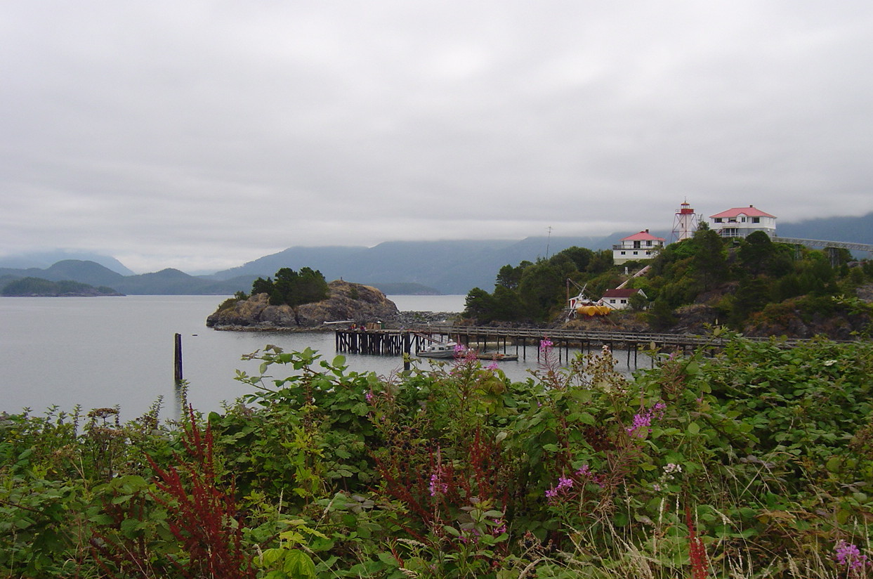
During the three years it took them to explore the west coast of North America, Vancouver’s vessels used Friendly Cove (Yuquot), at the mouth of Nootka Sound on what is now Vancouver Island, as a base to provision and refit. Yuquot had been James Cook’s first landfall in the region in 1778, and there was extensive and enthusiastic “fraternization” between some of his complement and local Indigenous women during that initial visit. “How agreeable their Company would be to us & how profitable to themselves,” said one of his people. Another deemed the women “Jolly, likely Wenches” and observed seamen stripping and washing them on board ship, for what end seems obvious.10 The documentation on this subject by Cook’s complement is generally wink-wink and waggish but it indicates that these interactions were transactional. The Mowachaht, the local indigenous people (now part of the Nuu-chah-nulth Tribal Council), had a strict social hierarchy; there is evidence that in response to their visitors’ interest in procuring women, they provided slaves (generally captives taken in battle or raids) to protect their own women, and received payment in return.
By 1790 the Spanish had an outpost at Yuquot, and British and American fur traders frequented its anchorage. The Mowachaht sold food and timber to them and supplied the traders with furs, acting as middlemen with other indigenous peoples. Much has been written about the marine fur trade centred on Nootka Sound. The sex trade that began with first contact is not well documented but is known to have continued throughout this period.11
Nothing is known of Thomas Pitt’s activities in Yuquot during his port-of-call stops there. However, evidence I have discovered suggests his behaviour on the west coast was consistent with that documented in Tahiti.
HMS Discovery in Nootka Sound
*
By the end of the second survey season, Captain Vancouver had had enough of the troublesome Midshipman Pitt. In February 1794 he dismissed him and put him aboard a supply ship bound for Port Jackson (today’s Sydney). Upon arrival there Pitt learned that his father had died; as heir, he had inherited his father’s considerable wealth and title. Now Baron Camelford, he returned to England. En route he secured a temporary commission on board HMS Resistance and performed commendably during the British navy’s campaign in the Dutch East Indies.12
Camelford harboured a seething resentment towards George Vancouver for his treatment and dismissal. When he arrived in England in September 1796 he sought out and demanded “satisfaction” from the ailing captain, challenging him repeatedly to a duel. Vancouver refused, defending his actions as entirely legitimate for a commander and officer of the Crown. If Camelford wished to file a formal grievance, he said, he would accept judgement on his own conduct from any flag officer in the navy.
In a rage, Camelford travelled to Vancouver’s home in Surrey, where he harangued and threatened him face-to-face. Vancouver endured Camelford’s threats and remained firm in his refusal to duel. Still, he worried that his refusal might be construed as dishonourable, and consulted Lord Grenville, the influential foreign minister who was also Camelford’s second cousin and brother-in-law (having married his sister). Grenville, and everyone else he spoke to, supported his stand.
Camelford continued issuing threats and insults and publically proclaimed Vancouver a poltroon for refusing to “provide satisfaction”. If Vancouver would not meet him in a duel, he declared, then he would seek him out, insult him publicly and fight to determine “which was the better man.” At this, Grenville intervened to admonish him, and Camelford seemed to cool down, claiming “the whole of the affair to be now concluded.” This proved patently false. Whether by design or chance, he encountered Vancouver and his brother on Conduit Street, London—ironically, they were on their way to arrange an injunction against Camelford. The young baron flew into a rage and beat them both with his walking stick.
The Caning in Conduit Street, by James Gillray, 1796
Physical injuries aside, the indignity caused Vancouver great public embarrassment. Camelford was subsequently required to post recognizance to keep the peace, but Vancouver’s request for an official public enquiry into his own conduct, which he felt would vindicate him and shed light on Camelford’s behaviour, was never approved. He lacked the influence to secure it. Pitt, meanwhile, had many influential friends among London’s privileged whispering classes who were ready and willing to disparage and ridicule Vancouver. James Gillray, the great political cartoonist, caricatured him. The redoubtable Sir Joseph Banks—made famous by his role as botanist on Cook’s first voyage and later head of the Royal Society—took it upon himself to collect evidence on Camelford’s mistreatment by Vancouver. No one came to Vancouver’s defence. As a result, the public standing of this remarkable, difficult, irascible, driven and accomplished man was irreparably damaged. When he died, he was still fighting for back pay from his voyage.
*
Although little is known about Thomas Pitt’s specific misdeeds on Discovery much is known of Camelford’s tempestuous life after his vendetta against his former captain. In 1797, through family influence (and despite his previous dismissal from the navy), he secured both a lieutenant’s commission and command of the sloop Favourite (irony abounds in the name). Not long after taking command, he shot and killed the commander of a sister vessel who declined to obey his orders; he was vindicated by a court martial, but returned to England to wait out the ensuing scandal. While waiting for a new command to be arranged, he was arrested trying to enter France, and implicated in a plot to assassinate Napoleon. That scandal finally ended his naval career. For the rest of his life he deeply resented Britain’s establishment, believing they had destroyed his prospects. In 1800, he publicly threatened the life of the prime minister, his cousin William Pitt, if he did not receive a new command. He neither received command nor suffered consequence. Toleration had its limits. The navy was through with him.
Camelford was forced to retire to the life of a fashionable (if eccentric) Georgian gentleman. He took his seat in the House of Lords, where he backed the privileges of class then veered erratically into radical politics. He was a rake, a patron of boxers, no mean pugilist himself; a frequenter of cock and dog fights, a bully who picked fights at random. Warm and generous to his friends, he bridled at slights to his honour. (Biographer Tolstoy suggests he was the model for Lord Chiltern in Anthony Trollope’s Phineas Finn13). He desperately desired glory and to prove himself on his own terms. This led him into further intrigue. He was again arrested and expelled from France, implicated in another plot against Napoleon. Rumour had it he had intended to take the First Consul’s life himself.
In March 1804, 29-year old Camelford squabbled with a drinking companion over a woman. He issued a challenge, and despite appeals to reason by his friends, refused to back down. It was a matter of honour, he said, and demanded satisfaction. The duellists met at dawn in a meadow near Holland House in Kensington. Camelford was mortally wounded in the exchange of shots. He lingered in pain for two days, his friends sitting grim vigil at his bedside. He showed courage and awareness in the face of death. According to Tolstoy, as the young lord lay dying, he expressed hope that his “suffering, coupled with what good he had managed to achieve in his life among all the ill, might operate in his favour in the next world.”14
His dying words, spoken to a former shipmate from the voyage, were reported to be “Tanash Mamathi”, which Tolstoy explained were “…the words used by the Indians of Nootka to signify the soul, which they pictured in the form of a little bird. In his dying hours Camelford’s mind had dwelt much on his boyhood and youth; now he had flown back in his thoughts to those stirring days when two young midshipmen had spent a long summer surveying creeks and promontories along the North American coast.”15
These are strange final words for an English peer. Thomas Pitt had spent a grand total of 50 days in Nootka Sound during the 1792 and 1793 survey seasons. When I read Tolstoy’s translation and explanation, something did not add up.
*
In August 2004, I visited Yuquot (Friendly Cove) to research The Wind From All Directions, which is set during the tense summit between George Vancouver and Spanish commodore Juan Francisco de la Bodega y Quadra in the autumn of 1792. I had the privilege of meeting members of the modern Mowachaht First Nation, and I took the opportunity to pose a rather odd question to several of them. What, I asked, does “Tanash Mamathi” mean?
Few modern Mowachaht speak their ancestral language. Generations of their people had it beaten out of them in residential schools. However those I asked instantly recognized the word “Mamathi” and provided its meaning. No one recognized the word “Tanash”. They all referred me to Ray Williams, one of the few Mowachaht elders who speak the language of their ancestors.
I approached Mr Williams who, with great dignity and tolerance, invited me into his home and listened to my query. He confirmed the definition of “Mamathi” that others had provided, and clarified my pronunciation. But at first he too was stumped by “Tanash”.
As he thought about it, he thought about the circumstances. If a man were dying, he’d be prone to miss a syllable; and those gathered around wouldn’t recognize the mistake. Anyone in that company who had heard the words before probably never heard them right in the first place. “Tanash”, he said, was likely “Wikhtinish”. And he explained what “Wikhtinish” meant.
“Mamathnhi” is the Moachaht word for white man. And “Wikhtinish Mamathnhi” means “crazy white man”. Was Thomas Pitt, Lord Camelford, crazy? His biographer Tolstoy called him “the half-mad lord”—which is what Trollope called his fictional Lord Chiltern. And now we know that two centuries ago, someone in Nootka Sound, obviously a Mowachaht, called him a “crazy white man.” We will never know why. All we can say is that the man who stalked, hounded and humiliated George Vancouver, who tarnished a good man’s reputation, was up to some mischief in Nootka Sound—and someone called him on it.
Notes:
1 For a comparative discussion of conditions (and discipline) on British naval vessels in the central Pacific between 1764 and 1795, see Greg Dening, Mr Bligh’s Bad Language: Passion, Power, and Theatre on the Bounty (Cambridge: Cambridge University Press, 1992).
2 Edward Bell, clerk of HMS Chatham, dated 28 Feb 1793; see W. Kaye Lamb, “Introduction” in George Vancouver, A Voyage of Discovery to the North Pacific Ocean and Round the World 1791-1795, 4 vols., ed. W. Kaye Lamb (London: Hakluyt Society, 1984), vol. 1, pp. 212-13.
3 Thomas Manby¸ master’s mate on Discovery, in 1793; see Vancouver, vol.4, pp. 1640-1. Thomas Manby was later master on Chatham and Third Lieutenant on Discovery. Manby was once reprimanded by Vancouver and said of his captain’s scolding “…his salutation I can never forget, and his language I will never forgive…” See Vancouver, vol. 2, p. 594n.
4 See John M. Naish, The Interwoven Lives of George Vancouver, Archibald Menzies, Joseph Whidbey and Peter Puget, Exploring the Pacific Northwest Coast, vol. 17 of the Canadian Studies Series (Queenston and Lewiston: Edwin Mellen Press,1996). Naish is a physician and on pp. 364-73 discusses Vancouver’s personality and symptoms.
5 Vancouver, vol. 2, p. 243
6 Ibid, pp. 243-4
7 Ibid, vol. 4, pp. 1581
8 Bern Anderson, The Life and Voyages of Captain George Vancouver, Surveyor of the Sea (Toronto: University of Toronto Press, 1960).
9 Ibid, p. 229
10 See Elliot Fox-Povey, “How Agreeable Their Company Would Be,” British Columbia Historical News, 36, no. 3 (Summer 2003), p. 3 and n. 23.
11 Ibid., pp. 8-9. Fox-Povey’s article is one of the few to examine this issue.
12 Nikolai Tolstoy, The Half-Mad Lord: Thomas Pitt, 2nd Baron Camelford (1775-1804) (London: Jonathan Cape, 1978), p. 28.
13 Tolstoy, pp. 142-9.
14 Ibid., p. 186.
15 Ibid.
This post is adapted from my article “George Vancouver and the Tanash Mamathi” published in the periodical Burney Letter (Spring 2011).
Cook’s vessels HMS Resolution and HMS Discovery approaching Nootka Sound, 1778
In these COVID times it’s good—no, necessary—to escape the headlines now and then, and the best way to escape modern times is to journey into history. I do that more than most: for some time I’ve been working on an historical novel set on Canada’s west coast. Its working title is The Wind From All Directions.
I’ve posted previously about the project, it’s locale, and some of its themes. Today I’ll set the true historical context for George Vancouver’s encounter with a Spanish commodore in remote Nootka Sound in 1792. What follows is adapted from a piece I wrote more than a decade ago. (Yes, this project has been around for a while.) It was originally published in the Spring 2010 edition of The Burney Letter.
I’ll post more historical context, and more about the fictional story set within that context, in the future. In the meantime, here’s the straight goods. No Fake News here.
*
In 1493, via a Papal Bull, Pope Alexander VI awarded the Spanish Crown titular sovereignty over a vast swath of territory that included the entire west coast of the Americas. Alexander was a Spaniard himself and the non-Catholic world paid no attention to his bull. For three hundred years the Spaniards busied themselves pillaging Mexico and Peru and did little to assert their claim to the area north of California. They made few voyages of exploration into the area and no attempts at settlement. But a few bold foreigners traversed the region. The English corsair Francis Drake was the first, in 1588, during his extended, round-the-world raid on Spanish dominions. (To this day Drake is considered a swashbuckling hero by the British, a vicious pirate by Latin Americans and Spaniards.) Then a succession of Russian adventurers probed south from the Aleutians. And, in 1778, Britain’s James Cook became the first European to land in present day British Columbia, when he anchored in Nootka Sound on Vancouver Island to make repairs to his ships Resolution and Discovery. Accompanying Cook on the voyage was a 20-year old midshipman named George Vancouver.
Cook’s brief sojourn in what he called Friendly Cove would provide Britain with grounds for a territorial claim to the region. His expedition returned home to tell of the plentiful sea otter population in the Pacific northwest, and the two thousand percent profit their furs fetched in China. This latter tidbit spawned a veritable gold rush. Adventurers and traders—mostly Britons and newly-independent Americans—set out on the long and arduous voyage to cash-in on the bounty.
Mowachaht village, Yuquot (Friendly Cove), 1784
One of them was a former Royal Navy officer named John Meares. In 1788 he built a trading post at Friendly Cove. Meares claimed he bought the site from Maquinna, chief of the local Mowachaht nation, for two pistols; one of his men said it cost ten sheets of copper and some trinkets. It was not the only inconsistency in Meares’s tale. Maquinna later called Meares a liar and denied there’d been any sale at all. Whatever the truth, Meares traded from his post all that summer, abandoned it in the fall and sailed for China, intending to return the following spring to resume operations.
Spain had learned of the presence of foreign traders in the area it called Neuva California. In early 1789 the Viceroy of New Spain dispatched two warships under Estevan Jose Martinez to establish a fortified post in Nootka Sound as a show of Spanish might. Martinez was a veteran of the few Spanish voyages into the region, an experienced mariner, but he was temperamental and volatile and had a liking for drink that impaired his judgement.
Martinez arrived in Friendly Cove in May 1789. He found no evidence of prior European activity (i.e. Meares’s trading post) upon the land. There were, however, several British, American and Portuguese trading vessels present in the area.
Martinez boarded and inspected these traders, questioned their captains about their activities, closely examined their papers. In short order he seized a Portuguese-flagged vessel whose captain’s papers were not up to snuff. Next he interviewed a British captain named James Colnett. At first Colnett declined to present his papers (which would not have withstood close scrutiny) and was evasive as to his plans. Later, in the great cabin of Martinez’s flagship Princesa, the two men had a violent argument. Colnett stomped on the deck, swore, called Martinez a “Goddam Spaniard,” and drew his sword. Colnett, it seems, was as hot-headed as Martinez, who arrested him at gunpoint, seized both his ships and detained their crews.
The arrest of Colnett, 1789
Their quarrel, in remote Nootka Sound, brought their two countries to the brink of war.
The impounded ships belonged to none other than John Meares and his partners. Meares had chosen not to return to the northwest that year, but to remain in China. Colnett, he thought, was eminently capable to lead the trading mission among the natives. He had not contemplated an encounter with the Spanish Empire.
Months later, when word of the seizures reached him in China, Meares realized he was facing financial ruin. He saw a single option and took it. He set off for England, where he arrived in April 1790 and lodged a complaint with the British government, claiming substantial losses from the seizure of his shore establishment and his two ships. Whatever the legitimacy of his claim to property on shore, his trading losses were real, and his case of British commerce unfairly restrained by an arrogant foreign power was received sympathetically. It happened to be timely, for the government, led by William Pitt, perceived its long-time foe Spain to be weak and saw an opportunity to weaken it further.
Public sentiment against Spain was quietly stoked. Angry speeches soon resounded in parliament and the press piled on. On April 30—just weeks after Meares first made his case—Cabinet responded to the furor by ordering mobilization of the fleet. Britain, it appeared, was ready to go to war over an argument between two hotheads in far off Nootka Sound.
John Bull was bluffing. Pitt and his ministers knew that Spain could not afford war. It was isolated diplomatically and militarily; its traditional ally France was in the early stages of a revolution and would not come to its aid.
As Pitt had calculated, the Spanish acceded to negotiations to avoid conflict. By late October an agreement was concluded. The Nootka Convention provided for full restitution of the ships, property and tracts of land seized by Martinez. The Spanish Armament (as the mobilization came to be known) ended with Britain winning all its diplomatic objectives, not least being recognition of the existence of British property on the northwest coast of America. This alone would undermine Spain’s claim to exclusive possession and sovereignty over the Pacific coast.
The outcome was sweet for Britain, given the support Spain had afforded the American revolutionaries not so long before. The loss of the American colonies still stung.
Even before the Convention was inked the Spaniards had released the impounded British ships and their crews. But an item of diplomacy remained to be transacted: the return of British-owned buildings and tracts of land on shore at Friendly Cove. George Vancouver, only 33 but a veteran of two of Cook’s voyages, had already been assigned command of a voyage of exploration to the region. He was now given an additional task: to satisfy the terms of the Convention, he would rendezvous with a Spanish counterpart in Nootka Sound to formally receive the British lands and territories seized by Martinez.
George Vancouver
Vancouver’s expedition, comprising the sloop Discovery (his first command) and the brig Chatham, sailed from England in April 1791.
HMS Discovery and HMS Chatham, painting by Steve Mayo
His original mission was ambitious enough. He was to chart an area spanning more than thirty degrees of latitude, thereby placing an immense tract of territory on the map of the known world. It is tempting to consider his diplomatic role an afterthought to that demanding goal—as the killing of two birds with one stone. But consider the inflamed passions of the period: his diplomatic mission was clearly as important to Britain’s interests as his survey mission.
Despite George Vancouver’s relative youth, he had already served 20 years in the Royal Navy, most of them at sea. He was an accomplished officer and hydrographer, intelligent, capable, dutiful—but completely unprepared for the role of diplomat. He was the son of a minor customs official—not high born but middle-class: definitely without pedigree. His ascension to command, like that of his mentor James Cook, and William Bligh, another of Cook’s officers, mirrored the slow evolution of British society and its institutions, to the point where men of capability could rise to command men of privilege. Common seamen had to put up and shut up with their captain’s authority. Officers, though, operated within a milieu of class distinction, and well-bred gentlemen bridled at the orders of social inferiors elevated over them—and there was no shortage of well-bred gentlemen on Vancouver’s Discovery. An extended voyage was considered a leg-up for the ambitious young sons of the elite, and strings were pulled to secure a goodly number berths on Vancouver’s vessels. In some cases pedigree trumped talent. It was ever thus.
Vancouver’s orders regarding his diplomatic role at Nootka were vague and incomplete. He was told that en route for the northwest the transport Daedalus would meet him in Hawaii to resupply his ships and deliver detailed instructions for completing his diplomatic mission.
But Daedalus missed the rendezvous. When it finally joined him at Friendly Cove in August 1792, just as he himself arrived from his first season of survey work, it delivered no additional instructions. George Vancouver, Master and Commander of Discovery, discovered he was on his own; and unbeknownst to him, the Spanish had resolved to win back their losses under the Nootka Convention. They had dispatched a seasoned officer, a Peruvian-born commodore named Juan Francisco de la Bodega y Quadra to the northwest to finesse their strategy and achieve their goals. Vancouver arrived in Nootka Sound to find a Spanish settlement, a garrison of troops and a fleet of Spanish men-of-war under Quadra’s command.
Juan Francisco de la Bodega y Quadra
*
More to come when I have time. In the meantime stay safe and have a great summer.
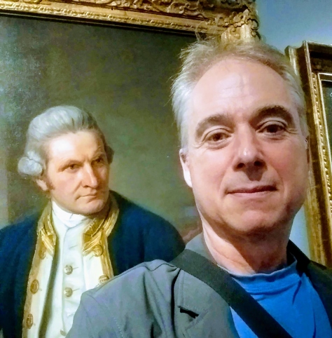
I’ve felt this man’s eyes on me for years. His and George Vancouver’s.
On a recent trip to the National Maritime Museum in Greenwich I discovered the famous 1775 portrait of the great mariner James Cook by Nathaniel Dance-Holland. I’ve done a lot of research on Cook and his era, and I’d seen this picture many times before, so it was a delight to discover the original there on the wall. So: selfie time. The resulting photo surprised me. I wonder if George Vancouver also felt Cook looking over his shoulder.
Vancouver was a midshipman on Cook’s last two voyages. With Cook, he twice circumnavigated the globe, spending more than eight years at sea. Thirteen years after Cook’s death, still only thirty-four, Vancouver was assigned to lead his own ambitious voyage of exploration. He was to complete the mapping of the northwest coast of North America, in the course of which he was to find or refute the existence of a navigable North West Passage.
My work-in-progress is set in Nootka Sound in 1792, during that epic voyage. I’ve long faced the challenge of how to tell an historical story with authenticity, how to be true to the characters and the age without losing contemporary readers. My initial effort produced a manuscript that veritably creaked with authenticity. Authenticity, good. Creaky, bad. I rethought it and eventually found a narrative voice that could accomplish what I wanted to do. It is omniscient, perhaps unreliable, egotistical, and it’s got attitude, which makes it fun, in a dangerous (though not Travis Bickle-dangerous) way. By dangerous, I mean unconventional.
My path to this approach was long and winding. Years ago, my daughter Kaitlin introduced me to a book she was reading at school: Markus Zusak’s The Book Thief, in which the narrator is Death. I loved that book and drew inspiration from it in solving my narration conundrum, though I haven’t gone as far as Zusak in using Death’s voice. Not quite, though my narrator has a unique perspective and plenty of character. I’ve also been inspired by the German writer W.G. Sebald, whose novel The Rings of Saturn is unlike any I’ve ever encountered. In the course of his story Sebald’s solitary, nameless narrator digresses into history, biography, literature and architecture. His narrative arc winds, not aimlessly, but delightfully. A friend gave me the book and said I’d like it, and I did, though perhaps not for the reasons he anticipated.
I’m pleased to say the narrative voice in my novel-in-progress (working title: The Wind From All Directions, “TWFAD”) works. I’m making good progress on the manuscript and am happy with it. I’m taking risks with voice, perspective, and story-telling in general. I’m painting outside the lines and don’t give a damn about breaking literary convention. The way I see it, if you’re painting within the lines—if you can see lines—well, you’re working on someone else’s painting. What about your own? This is my last novel. I see no need to hold back now. What do I have to lose?
Now back to Greenwich. It was a pleasurable working visit, the best kind. I did some research there for TWFAD that I could do nowhere else. I was there to investigate time and ogle the chronometers housed at the Maritime Museum and up the hill at the Royal Observatory.
John Harrison’s famous “sea watch,” known as H4, and its predecessors H1, H2 and H3 (all of which are still in working order), are on exhibit at the Observatory, where there is a very thorough, very accessible audible tour. If you’ve read Dava Sobel’s Longitude (nerd alert: Yes, of course I have.) you’ll know the significance of these chronometers. H4 was the timepiece that solved the great conundrum of marine navigators, the problem of determining longitude at sea, a problem that had preoccupied astronomers, mathematicians, horologists and instrument-makers for decades.
H4 was a masterpiece, a work of genius, a breakthrough for science and instrumentation, but a one-off. It was so expensive that it was impractical as a day-to-day solution for ships at sea. The navy could not afford to equip all its vessels with such a piece, and it was completely out of reach for the owners of merchant vessels.
The effort began to simplify the clock’s movement and cut costs. Britain’s Board of Longitude commissioned watchmaker Larcum Kendall to copy H4 with those objectives in mind. In 1770 he produced a timepiece called K1, which James Cook tested on his second voyage—George Vancouver’s first. K1 worked superbly—Cook referred to it as “our trusty friend the Watch.” It proved that H4’s success was no fluke. Kendall went on to produce K2 in 1772, and K3 in 1774, both cheaper, though inferior to K1. Cook took both K1 and K3 on his third and final voyage. K3 remained in service for many years. It was assigned to George Vancouver for his great expedition in 1791. It proved erratic in its running rate, although it was superior to other chronometers he was provided with. K2, by the way, was assigned to William Bligh (who was on Cook’s fateful third voyage with Vancouver) in 1787 for his voyage to Tahiti on HMS Bounty. It remained on the ship when Bligh was set adrift in the Pacific by Fletcher Christian. Christian took it to Pitcairn Island where he scuttled Bounty. Years later the last surviving mutineer on Pitcairn gave K2 to the captain of a visiting ship. It was eventually returned to Britain. It is exhibited in the Maritime Museum alongside K1 and K3.
These historic timepieces are awe-inspiring for anyone (such as yours truly) who finds inspiration in the long and ultimately successful quest for a solution to the vexing problem of longitude.
Here are some pictures of these historic timepieces and other eighteenth century navigational equipment housed at the National Maritime Museum or the Royal Observatory in Greenwich.


 Cook’s vessels HMS Resolution and HMS Discovery approaching Nootka Sound, 1778
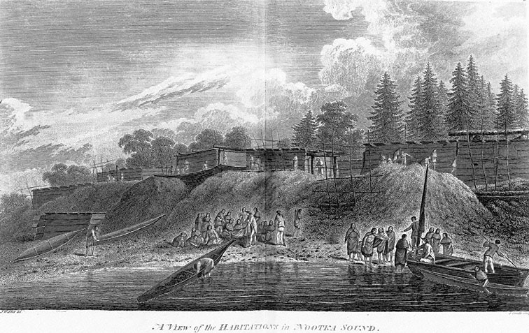


 I’ve felt this man’s eyes on me for years. His and George Vancouver’s.